Original file (2,000 × 3,000 pixels, file size: 529 KB, MIME type: image/png)
| This is a file from the Wikimedia Commons. Information from its description page there is shown below. Commons is a freely licensed media file repository. You can help. |
Summary
| Description |
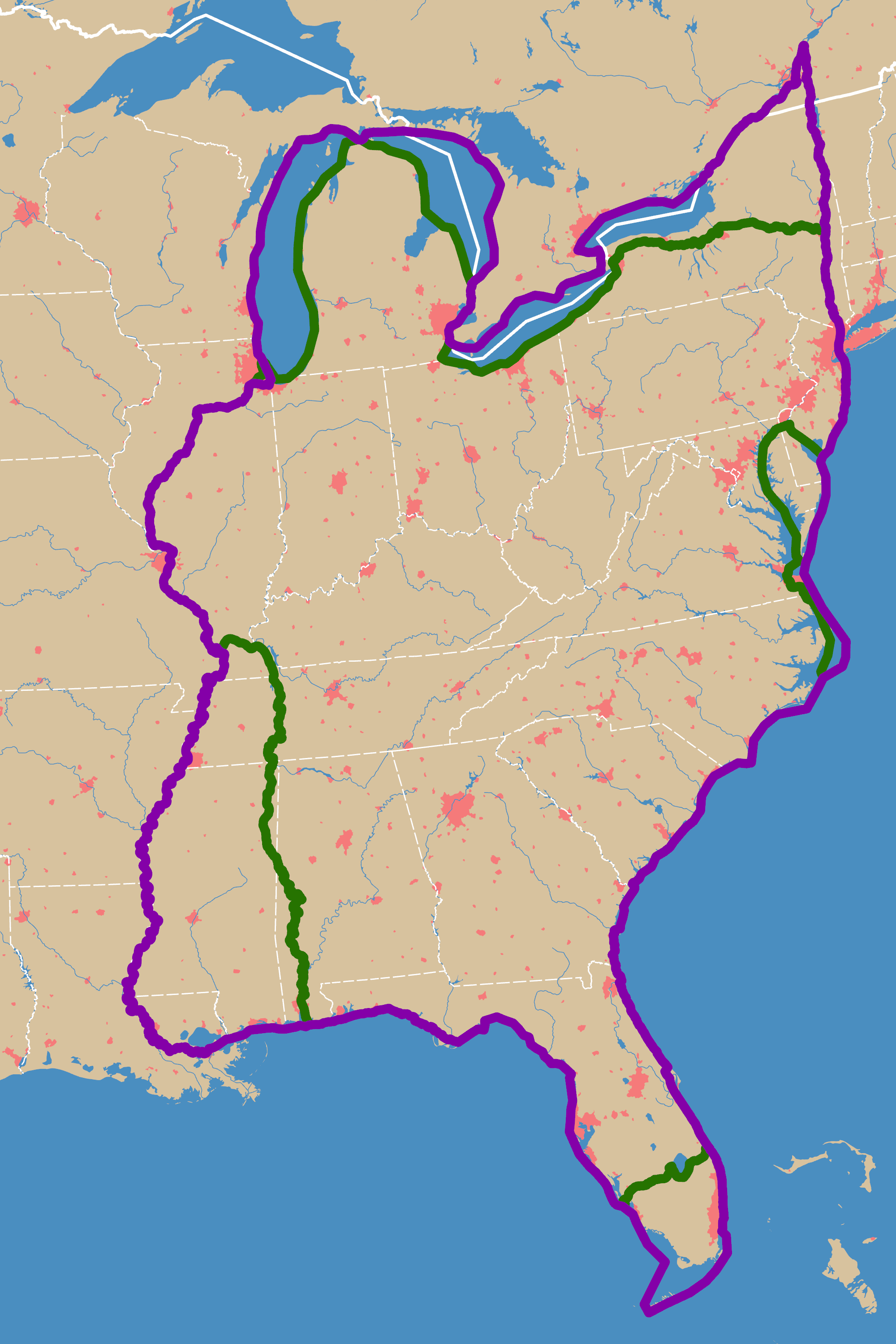
English: Two possible routes to complete the Great Loop |
||
| Date | |||
| Source | Own work | ||
| Creator | |||
| Credit line | © Tom Fish, geo.fish // Creative Commons BY-SA 4.0 | ||
| Permission (Reusing this file) |
|
||
| Georeferencing | If inappropriate please set warp_status = skip to hide. | ||
| PNG development | This map was created with ArcGIS Pro. |
Licensing
Data
Land and international borders
The international boundaries were sourced from the Large Scale International Boundaries published by the US Department of State
| This image is a work of a United States Department of State employee, taken or made as part of that person's official duties. As a work of the U.S. federal government, the image is in the public domain per 17 U.S.C. § 101 and § 105 and the Department Copyright Information. |  |
Rivers and lakes
| This file uses data that was sourced from Natural Earth, a public domain dataset. From the terms of use:
All versions of Natural Earth raster + vector map data found on this website are in the public domain. You may use the maps in any manner, including modifying the content and design, electronic dissemination, and offset printing. The primary authors, Tom Patterson and Nathaniel Vaughn Kelso, and all other contributors renounce all financial claim to the maps and invites you to use them for personal, educational, and commercial purposes. |
State boundary
The state boundaries are sourced from STATE_BOUNDS the United States Geological Survey
This image is in the public domain in the United States because it only contains materials that originally came from the United States Geological Survey, an agency of the United States Department of the Interior. For more information, see the official USGS copyright policy.
|
Final Map
- You are free:
- to share – to copy, distribute and transmit the work
- to remix – to adapt the work
- Under the following conditions:
- attribution – You must give appropriate credit, provide a link to the license, and indicate if changes were made. You may do so in any reasonable manner, but not in any way that suggests the licensor endorses you or your use.
- share alike – If you remix, transform, or build upon the material, you must distribute your contributions under the same or compatible license as the original.
File history
Click on a date/time to view the file as it appeared at that time.
| Date/Time | Thumbnail | Dimensions | User | Comment | |
|---|---|---|---|---|---|
| current | 15:57, 19 November 2021 | | 2,000 × 3,000 (529 KB) | Guerillero | Yellow -> Purple |
| 15:43, 19 November 2021 |  | 2,000 × 3,000 (525 KB) | Guerillero | == {{int:filedesc}} == {{User:Guerillero/Template |Description= {{en|Two possible routes to complete the Great Loop}} |Date= 19 November 2021 }} == {{int:license-header}} == ===Data=== ====Land and international borders==== The international boundaries were sourced from the Large Scale International Boundaries published by the US Department of State {{PD-USGov-DOS}} ====Rivers and lakes==== The rivers, lakes, land, and cities are from the [https://www.naturalearthdata.... |
File usage
Global file usage
The following other wikis use this file:
- Usage on ru.wikipedia.org