
Original file (4,000 × 3,000 pixels, file size: 3.92 MB, MIME type: image/jpeg)
Summary edit
| Description |
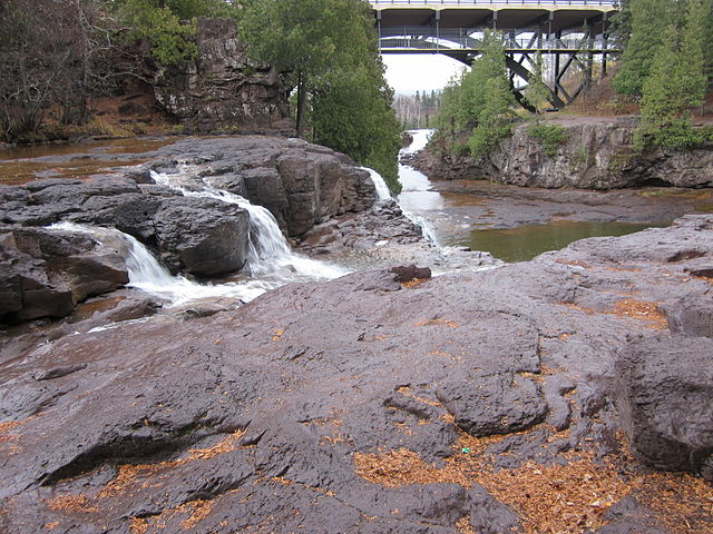
Gooseberry River, Lake County, Minnesota, within Gooseberry Falls State Park. Shows the top step of the upper falls in the lower left and the MN Highway 61 bridge running overhead. Middle Falls are located where river disappears under bridge. |
|---|---|
| Source |
Own work |
| Date |
2011-10-30 |
| Author | |
| Permission (Reusing this file) |
See below.
|
- Other information
Taken on a Canon PowerShot SD 1300 IS, F-stop f/2.8, Exposure time 1/30 sec, focal length 5mm.
Licensing edit
 | Permission is granted to copy, distribute and/or modify this document under the terms of the GNU Free Documentation License, Version 1.2 or any later version published by the Free Software Foundation; with no Invariant Sections, no Front-Cover Texts, and no Back-Cover Texts. |
| This work is licensed under the Creative Commons Attribution-ShareAlike 3.0 License. |
 | This file is a candidate to be copied to Wikimedia Commons.
Any user may perform this transfer; refer to Wikipedia:Moving files to Commons for details. If this file has problems with attribution, copyright, or is otherwise ineligible for Commons, then remove this tag and DO NOT transfer it; repeat violators may be blocked from editing. Other Instructions
| ||
| |||
File history
Click on a date/time to view the file as it appeared at that time.
| Date/Time | Thumbnail | Dimensions | User | Comment | |
|---|---|---|---|---|---|
| current | 23:27, 24 January 2013 | | 4,000 × 3,000 (3.92 MB) | Norstrem (talk | contribs) | Uploading a self-made file using File Upload Wizard |
You cannot overwrite this file.