
Size of this preview: 800 × 537 pixels. Other resolutions: 320 × 215 pixels | 640 × 430 pixels | 1,024 × 687 pixels | 1,280 × 859 pixels | 2,336 × 1,568 pixels.
Original file (2,336 × 1,568 pixels, file size: 328 KB, MIME type: image/jpeg)
| This is a file from the Wikimedia Commons. Information from its description page there is shown below. Commons is a freely licensed media file repository. You can help. |
Summary
| Description |
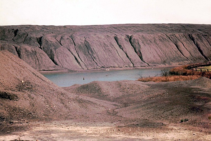
English: Gin Pit rucks 1974 Spoil heaps riven with gullies and a deep 'flash' make this scene from 1974 completely unrecognisable now. This area of former mining waste between Higher Folds and Gin Pit village has long since been landscaped. |
| Date | |
| Source | From geograph.org.uk |
| Author | Chris Denny |
| Attribution (required by the license) | Chris Denny / Gin Pit rucks 1974 / |
| Camera location | | View this and other nearby images on: OpenStreetMap |
|---|
_heading:45.00&language=en)
| Object location | | View this and other nearby images on: OpenStreetMap |
|---|
_heading:45.00&language=en)
Licensing

|
This image was taken from the Geograph project collection. See this photograph's page on the Geograph website for the photographer's contact details. The copyright on this image is owned by Chris Denny and is licensed for reuse under the Creative Commons Attribution-ShareAlike 2.0 license.
|
This file is licensed under the Creative Commons Attribution-Share Alike 2.0 Generic license.
Attribution: Chris Denny
- You are free:
- to share – to copy, distribute and transmit the work
- to remix – to adapt the work
- Under the following conditions:
- attribution – You must give appropriate credit, provide a link to the license, and indicate if changes were made. You may do so in any reasonable manner, but not in any way that suggests the licensor endorses you or your use.
- share alike – If you remix, transform, or build upon the material, you must distribute your contributions under the same or compatible license as the original.
File history
Click on a date/time to view the file as it appeared at that time.
| Date/Time | Thumbnail | Dimensions | User | Comment | |
|---|---|---|---|---|---|
| current | 23:04, 11 March 2011 | | 2,336 × 1,568 (328 KB) | GeographBot | == {{int:filedesc}} == {{Information |description={{en|1=Gin Pit rucks 1974 Spoil heaps riven with gullies and a deep 'flash' make this scene from 1974 completely unrecognisable now. This area of former mining waste between Higher Folds and Gin Pit villag |
File usage
The following pages on the English Wikipedia use this file (pages on other projects are not listed):
Global file usage
The following other wikis use this file:
- Usage on sr.wikipedia.org