No higher resolution available.
Esher_Place_1737.jpg (600 × 322 pixels, file size: 56 KB, MIME type: image/jpeg)
| This is a file from the Wikimedia Commons. Information from its description page there is shown below. Commons is a freely licensed media file repository. You can help. |
Summary
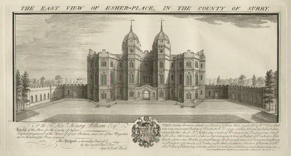
| Description |
English: East View of Esher Place, Surrey , England in 1737.
A line engraving drawn and engraved by the brothers Samuel and Nathaniel Buck. The print is dated to 1737. |
| Date | |
| Source | http://www.antique-prints-maps.com/acatalog/England_antique_prints.html |
| Author | Unknown author |
| Camera location | | View this and other nearby images on: OpenStreetMap |
|---|
Licensing
|
This work is in the public domain in its country of origin and other countries and areas where the copyright term is the author's life plus 100 years or fewer. This work is in the public domain in the United States because it was published (or registered with the U.S. Copyright Office) before January 1, 1929. | |
| This file has been identified as being free of known restrictions under copyright law, including all related and neighboring rights. | |
File history
Click on a date/time to view the file as it appeared at that time.
| Date/Time | Thumbnail | Dimensions | User | Comment | |
|---|---|---|---|---|---|
| current | 00:45, 25 January 2015 | | 600 × 322 (56 KB) | Lumos3 | User created page with UploadWizard |
File usage
The following pages on the English Wikipedia use this file (pages on other projects are not listed):