
Size of this preview: 796 × 600 pixels. Other resolutions: 319 × 240 pixels | 637 × 480 pixels | 1,019 × 768 pixels | 1,280 × 965 pixels | 2,560 × 1,930 pixels | 2,940 × 2,216 pixels.
Original file (2,940 × 2,216 pixels, file size: 2.29 MB, MIME type: image/jpeg)
| This is a file from the Wikimedia Commons. Information from its description page there is shown below. Commons is a freely licensed media file repository. You can help. |
Summary
| Description |
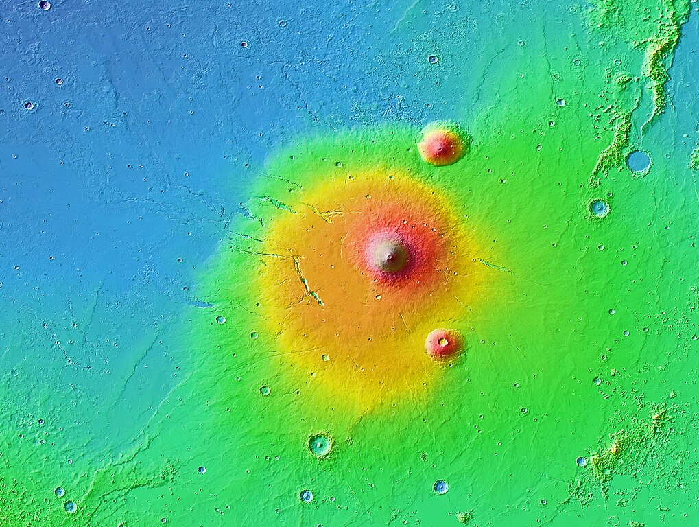
English: A colorized topographic map of the volcanic province Elysium, together with its surroundings, from the Mars Orbiter Laser Altimeter (MOLA) instrument of the Mars Global Surveyor spacecraft. Elysium, in the eastern hemisphere of Mars, is the second largest volcanic region on the planet, after Tharsis. The largest shield volcano, Elysium Mons, is at center, while the smaller volcanoes Hecates Tholus and Albor Tholus are to the former's upper and lower right, respectively. Some of the features in this image are annotated in Wikimedia Commons. |
| Date | |
| Source | JMARS |
| Author | NASA / JPL-Caltech / Arizona State University |
| Other versions |

|

Licensing
| This file is in the public domain in the United States because it was solely created by NASA. NASA copyright policy states that "NASA material is not protected by copyright unless noted". (See Template:PD-USGov, NASA copyright policy page or JPL Image Use Policy.) | ||
 |
Warnings:
|
| Annotations | This image is annotated: View the annotations at Commons |
File history
Click on a date/time to view the file as it appeared at that time.
| Date/Time | Thumbnail | Dimensions | User | Comment | |
|---|---|---|---|---|---|
| current | 07:30, 29 July 2013 | | 2,940 × 2,216 (2.29 MB) | WolfmanSF | User created page with UploadWizard |
File usage
The following pages on the English Wikipedia use this file (pages on other projects are not listed):
Global file usage
The following other wikis use this file:
- Usage on fa.wikipedia.org
- Usage on fr.wikipedia.org
- Usage on hr.wikipedia.org
- Usage on pl.wikipedia.org
- Usage on uk.wikipedia.org
- Usage on zh.wikipedia.org