Size of this preview: 798 × 600 pixels. Other resolutions: 320 × 240 pixels | 639 × 480 pixels | 1,022 × 768 pixels | 1,280 × 962 pixels | 2,413 × 1,813 pixels.
Original file (2,413 × 1,813 pixels, file size: 981 KB, MIME type: image/jpeg)
| This is a file from the Wikimedia Commons. Information from its description page there is shown below. Commons is a freely licensed media file repository. You can help. |
Summary
| Description |
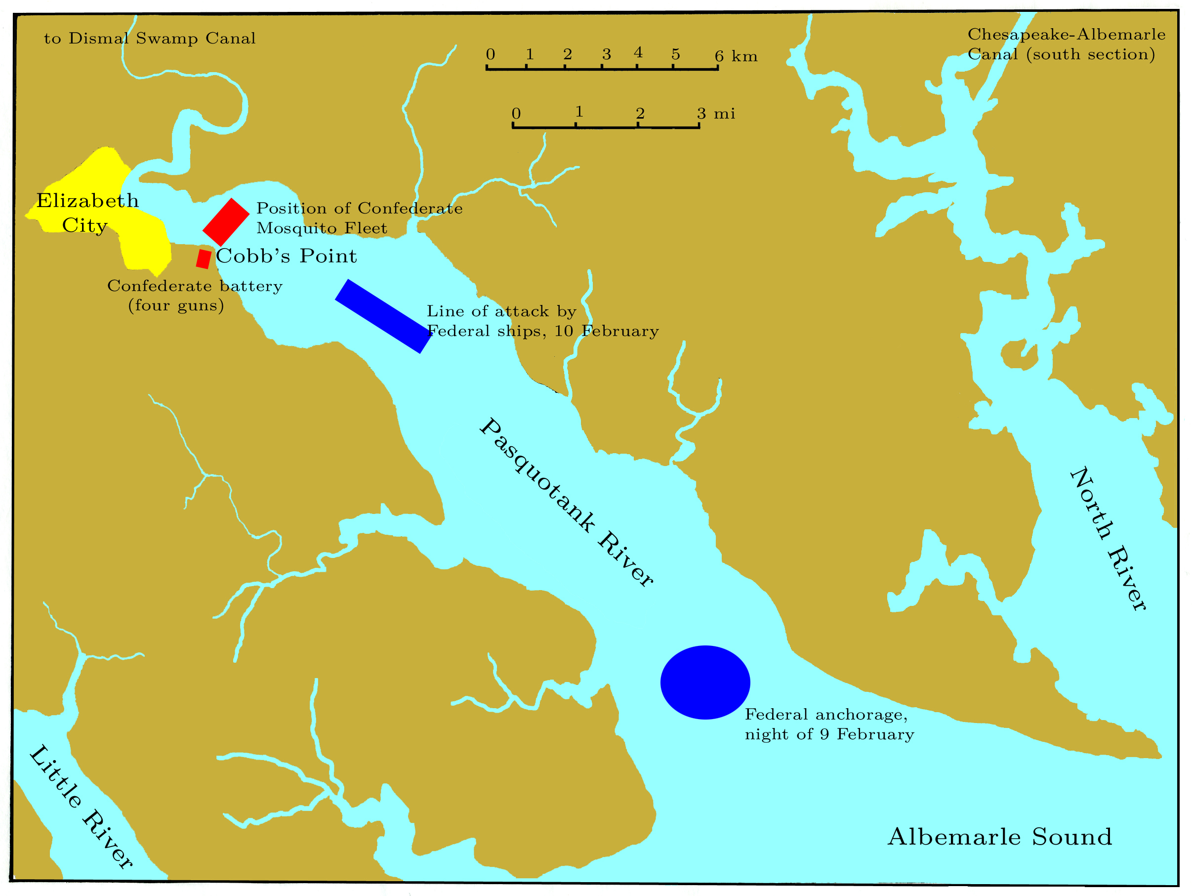
English: Chart of the Pasquotank River near Elizabeth City, NC, showing the Confederate defenses and the attacking Federal column of ships at the Battle of Elizabeth City, 10 February 1862. |
| Date | |
| Source | Own work |
| Author | self |
Hand-traced from a map prepared by the United States Geological Survey, not subject to copyright. All of my modifications are hereby released into the public domain.
Licensing
| I, the copyright holder of this work, release this work into the public domain. This applies worldwide. In some countries this may not be legally possible; if so: I grant anyone the right to use this work for any purpose, without any conditions, unless such conditions are required by law. |
File history
Click on a date/time to view the file as it appeared at that time.
| Date/Time | Thumbnail | Dimensions | User | Comment | |
|---|---|---|---|---|---|
| current | 23:43, 20 September 2009 | | 2,413 × 1,813 (981 KB) | Pkkphysicist | {{Information |Description={{en|1=Chart of the Pasquotank River near Elizabeth City, NC, showing the Confederate defenses and the attacking Federal column of ships at the Battle of Elizabeth City, 10 February 1862.}} |Source=Own work |Author=self |Date=20 |
File usage
The following pages on the English Wikipedia use this file (pages on other projects are not listed):
Global file usage
The following other wikis use this file:
- Usage on fr.wikipedia.org
- Usage on nl.wikipedia.org