
Size of this PNG preview of this SVG file: 686 × 457 pixels. Other resolutions: 320 × 213 pixels | 640 × 426 pixels | 1,024 × 682 pixels | 1,280 × 853 pixels | 2,560 × 1,705 pixels.
Original file (SVG file, nominally 686 × 457 pixels, file size: 999 KB)
| This is a file from the Wikimedia Commons. Information from its description page there is shown below. Commons is a freely licensed media file repository. You can help. |
Summary
| Description |
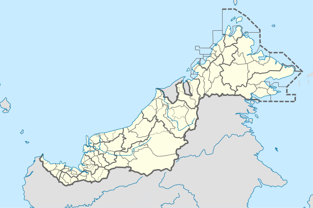
English: Location map of East Malaysia (with districts). |
| Date | |
| Source | Own work |
| Author | Hellerick |
| Other versions |
Licensing
I, the copyright holder of this work, hereby publish it under the following license:
This file is licensed under the Creative Commons Attribution-Share Alike 4.0 International license.
- You are free:
- to share – to copy, distribute and transmit the work
- to remix – to adapt the work
- Under the following conditions:
- attribution – You must give appropriate credit, provide a link to the license, and indicate if changes were made. You may do so in any reasonable manner, but not in any way that suggests the licensor endorses you or your use.
- share alike – If you remix, transform, or build upon the material, you must distribute your contributions under the same or compatible license as the original.
File history
Click on a date/time to view the file as it appeared at that time.
| Date/Time | Thumbnail | Dimensions | User | Comment | |
|---|---|---|---|---|---|
| current | 10:03, 18 October 2023 | | 686 × 457 (999 KB) | Zh9567 | add Membakut District: https://mygos.mygeoportal.gov.my/upi/ and Balai Ringin sub-district: https://serian.sarawak.gov.my/web/subpage/webpage_view/174 |
| 13:25, 28 July 2023 |  | 686 × 457 (996 KB) | Zh9567 | update Sarawak new districts: https://www.dosm.gov.my/uploads/content-downloads/file_20221107000029.pdf | |
| 09:44, 10 April 2020 |  | 686 × 457 (999 KB) | *angys* | UPDATE | |
| 12:42, 17 April 2019 |  | 686 × 457 (2.32 MB) | *angys* | correcting borders | |
| 06:01, 13 July 2018 |  | 686 × 457 (1.86 MB) | Hellerick | + Borders withing Miri Division | |
| 05:01, 13 July 2018 |  | 686 × 457 (1.85 MB) | Molecule Extraction | correcting Telupid border per http://ww2.sabah.gov.my/pd.tlp/Pages/Peta_DK_Telupid.html | |
| 13:57, 30 June 2018 |  | 686 × 457 (1.85 MB) | Hellerick | + Telupid District | |
| 15:32, 27 December 2017 |  | 686 × 457 (1.76 MB) | Hellerick | Kuala Terengganu borders corrected | |
| 16:19, 25 December 2017 |  | 686 × 457 (1.76 MB) | Hellerick | correcting district borders | |
| 17:32, 22 December 2017 |  | 689 × 459 (1.75 MB) | Hellerick | User created page with UploadWizard |
File usage
The following pages on the English Wikipedia use this file (pages on other projects are not listed):
Global file usage
The following other wikis use this file:
- Usage on bn.wikipedia.org
- Usage on ja.wikipedia.org
- Usage on ml.wikipedia.org
- Usage on ms.wikipedia.org
- Usage on simple.wikipedia.org
- Usage on si.wikipedia.org
- Usage on th.wikipedia.org
- Usage on uz.wikipedia.org
- Usage on zh-yue.wikipedia.org
- Usage on zh.wikipedia.org