Size of this preview: 800 × 518 pixels. Other resolutions: 320 × 207 pixels | 640 × 414 pixels | 1,024 × 663 pixels | 1,280 × 828 pixels | 1,989 × 1,287 pixels.
Original file (1,989 × 1,287 pixels, file size: 471 KB, MIME type: image/jpeg)
| This is a file from the Wikimedia Commons. Information from its description page there is shown below. Commons is a freely licensed media file repository. You can help. |
Summary
| Description |
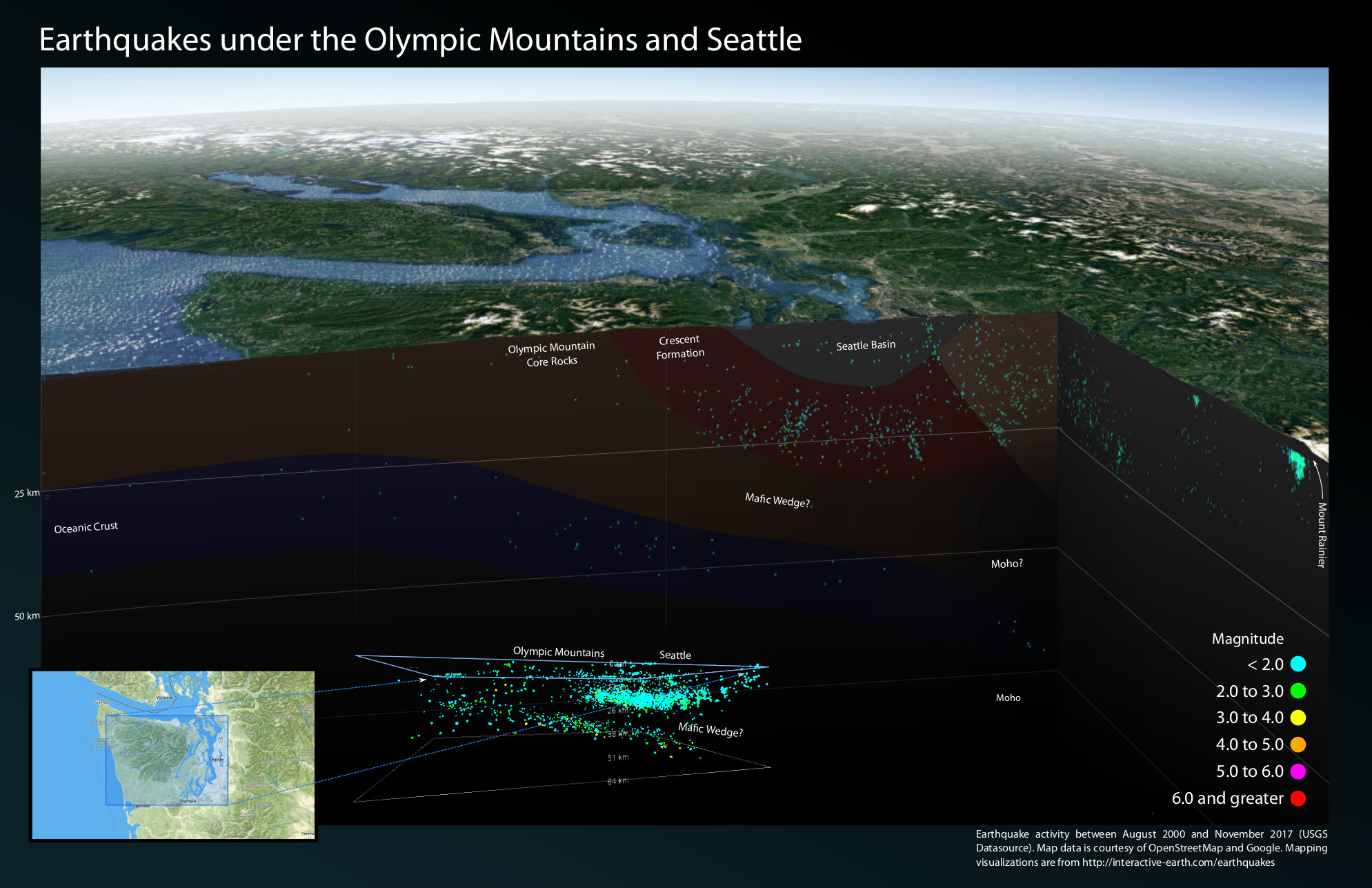
English: Displays earthquakes in a cross section from the Olympic Mountains east to Seattle and south to Mount Rainer in the Cascadia Subduction Zone. |
| Date | |
| Source | Own work |
| Author | Davezelenka |
| Camera location | | View this and other nearby images on: OpenStreetMap |
|---|
 |
This image was a finalist in the 2017 Wiki Science Competition in the United States. |
Licensing
I, the copyright holder of this work, hereby publish it under the following license:
This file is licensed under the Creative Commons Attribution 4.0 International license.
- You are free:
- to share – to copy, distribute and transmit the work
- to remix – to adapt the work
- Under the following conditions:
- attribution – You must give appropriate credit, provide a link to the license, and indicate if changes were made. You may do so in any reasonable manner, but not in any way that suggests the licensor endorses you or your use.
| This image was uploaded as part of Wiki Science Competition 2017. |
File history
Click on a date/time to view the file as it appeared at that time.
| Date/Time | Thumbnail | Dimensions | User | Comment | |
|---|---|---|---|---|---|
| current | 23:36, 30 November 2017 | | 1,989 × 1,287 (471 KB) | Davezelenka | User created page with UploadWizard |
File usage
The following pages on the English Wikipedia use this file (pages on other projects are not listed):
Global file usage
The following other wikis use this file:
- Usage on uk.wikipedia.org