Size of this preview: 800 × 600 pixels. Other resolutions: 320 × 240 pixels | 640 × 480 pixels | 1,024 × 768 pixels | 1,280 × 960 pixels | 2,560 × 1,920 pixels.
Original file (2,560 × 1,920 pixels, file size: 986 KB, MIME type: image/jpeg)
| This is a file from the Wikimedia Commons. Information from its description page there is shown below. Commons is a freely licensed media file repository. You can help. |
Summary
| Description |
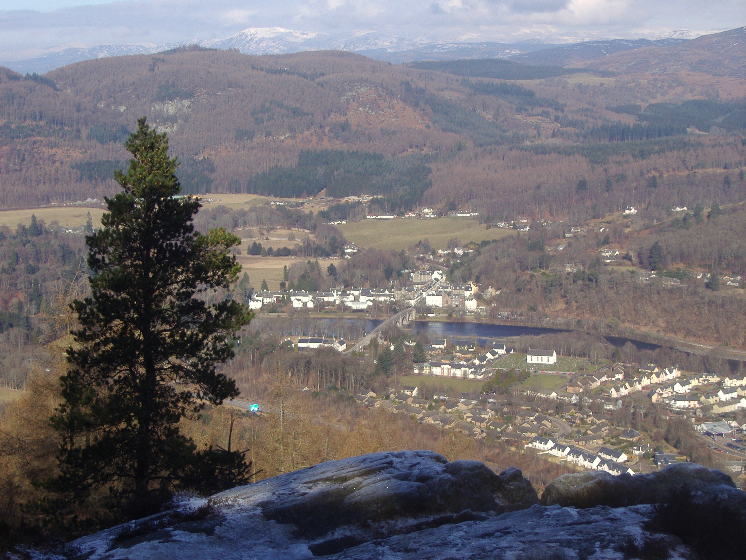
English: Dunkeld Translated into English from the Gaelic word "Dun Chailleann" (fort of the Caledonians), this tranquil Perthshire town, boasting a magnificent ruined medieval cathedral by the banks of the River Tay, continues to remain a popular tourist destination.
The bridge in the centre of the photograph, dating from 1809, was built by the renowned civil engineer, Thomas Telford. |
| Date | |
| Source | From geograph.org.uk |
| Author | Euan Nelson |
| Attribution (required by the license) | Euan Nelson / Dunkeld / |
| Camera location | | View this and other nearby images on: OpenStreetMap |
|---|
_heading:337.00&language=en)
| Object location | | View this and other nearby images on: OpenStreetMap |
|---|
_heading:337.00&language=en)
Licensing

|
This image was taken from the Geograph project collection. See this photograph's page on the Geograph website for the photographer's contact details. The copyright on this image is owned by Euan Nelson and is licensed for reuse under the Creative Commons Attribution-ShareAlike 2.0 license.
|
This file is licensed under the Creative Commons Attribution-Share Alike 2.0 Generic license.
Attribution: Euan Nelson
- You are free:
- to share – to copy, distribute and transmit the work
- to remix – to adapt the work
- Under the following conditions:
- attribution – You must give appropriate credit, provide a link to the license, and indicate if changes were made. You may do so in any reasonable manner, but not in any way that suggests the licensor endorses you or your use.
- share alike – If you remix, transform, or build upon the material, you must distribute your contributions under the same or compatible license as the original.
File history
Click on a date/time to view the file as it appeared at that time.
| Date/Time | Thumbnail | Dimensions | User | Comment | |
|---|---|---|---|---|---|
| current | 11:32, 5 March 2011 | | 2,560 × 1,920 (986 KB) | GeographBot | == {{int:filedesc}} == {{Information |description={{en|1=Dunkeld Translated into English from the Gaelic word "Dun Chailleann" (fort of the Caledonians), this tranquil Perthshire town, boasting a magnificent ruined medieval cathedral by the banks of the R |
File usage
The following pages on the English Wikipedia use this file (pages on other projects are not listed):
Global file usage
The following other wikis use this file: