
Size of this preview: 800 × 474 pixels. Other resolutions: 320 × 190 pixels | 640 × 379 pixels | 930 × 551 pixels.
Original file (930 × 551 pixels, file size: 35 KB, MIME type: image/png)
| This is a file from the Wikimedia Commons. Information from its description page there is shown below. Commons is a freely licensed media file repository. You can help. |
| Description |
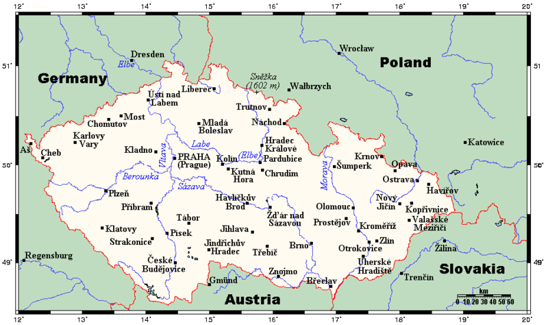
English: A map showing the Czech Republic's main cities and towns, and nearby areas in neighbouring countries. This map's source is here, with the uploader's modifications, and the GMT homepage says that the tools are released under the GNU General Public License. |
| Date | 26 July 2007 (original upload date) |
| Source | Transferred from en.wikipedia to Commons by Georgez. |
| Author | Kelisi at English Wikipedia |
Licensing
Kelisi at the English-language Wikipedia, the copyright holder of this work, hereby publishes it under the following license:
| This file is licensed under the Creative Commons Attribution-Share Alike 3.0 Unported license. Subject to disclaimers. | ||
| Attribution: Kelisi at the English-language Wikipedia | ||
| ||
| This licensing tag was added to this file as part of the GFDL licensing update. |

|
Permission is granted to copy, distribute and/or modify this document under the terms of the GNU Free Documentation License, Version 1.2 or any later version published by the Free Software Foundation; with no Invariant Sections, no Front-Cover Texts, and no Back-Cover Texts. A copy of the license is included in the section entitled GNU Free Documentation License. Subject to disclaimers. |
Original upload log
The original description page was here. All following user names refer to en.wikipedia.
- 2007-07-26 22:40 Kelisi 930×551× (32250 bytes) oops
- 2007-07-26 22:38 Kelisi 930×551× (32273 bytes) Adding Sněžka.
- 2007-07-15 17:09 Kelisi 930×551× (31855 bytes) == Summary == A map showing the Czech Republic's main cities and towns, and nearby areas in neighbouring countries. This map's source is [http://www.aquarius.ifm-geomar.de/ here], with the uploader's modifications, and the [http://gmt.soest.hawaii.edu/ GM
File history
Click on a date/time to view the file as it appeared at that time.
| Date/Time | Thumbnail | Dimensions | User | Comment | |
|---|---|---|---|---|---|
| current | 17:21, 10 February 2012 | | 930 × 551 (35 KB) | Miaow Miaow | added city of Opava |
| 16:15, 10 February 2012 |  | 930 × 551 (32 KB) | Miaow Miaow | removed Líšeň (presumably a tongue-in-cheek addition by the original creator ?), which is merely a suburb of Brno and of much less importance than other cities depicted | |
| 15:57, 25 March 2009 |  | 930 × 551 (31 KB) | Georgez | {{Information |Description={{en|A map showing the Czech Republic's main cities and towns, and nearby areas in neighbouring countries. This map's source is [http://www.aquarius.ifm-geomar.de/ here], with the uploader's modifications, and the [http://gmt.so |
File usage
The following pages on the English Wikipedia use this file (pages on other projects are not listed):
Global file usage
The following other wikis use this file:
- Usage on ar.wikipedia.org
- Usage on bs.wikipedia.org
- Usage on el.wikipedia.org
- Usage on ja.wikipedia.org
- Usage on lt.wikipedia.org
- Usage on mk.wikipedia.org
- Usage on pt.wikipedia.org