Size of this preview: 800 × 533 pixels. Other resolutions: 320 × 213 pixels | 640 × 426 pixels | 1,024 × 682 pixels | 1,280 × 852 pixels | 1,600 × 1,065 pixels.
Original file (1,600 × 1,065 pixels, file size: 371 KB, MIME type: image/jpeg)
| This is a file from the Wikimedia Commons. Information from its description page there is shown below. Commons is a freely licensed media file repository. You can help. |
| This image appeared on Wikipedia's Main Page in the Did you know? column on 12 March 2010 (see archives). |
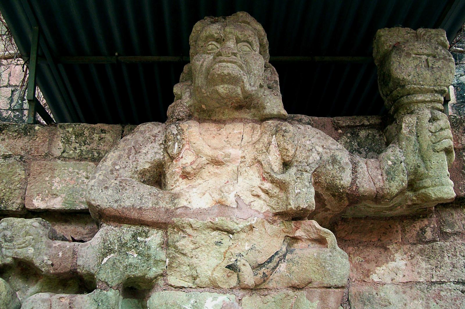
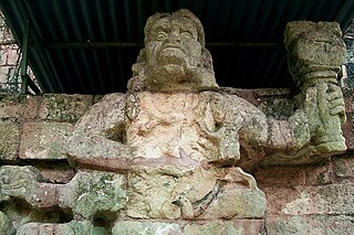
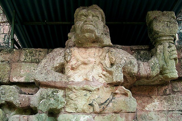
| Description | World Heritage Site of Copan |
| Date | |
| Source | Copan Ruinas |
| Author | Adalberto Hernandez Vega from Copan Ruinas, Honduras |
| Camera location | | View this and other nearby images on: OpenStreetMap |
|---|
Licensing
This file is licensed under the Creative Commons Attribution 2.0 Generic license.
- You are free:
- to share – to copy, distribute and transmit the work
- to remix – to adapt the work
- Under the following conditions:
- attribution – You must give appropriate credit, provide a link to the license, and indicate if changes were made. You may do so in any reasonable manner, but not in any way that suggests the licensor endorses you or your use.
| This image was originally posted to Flickr by Adal-Honduras at https://www.flickr.com/photos/62237390@N00/3530479651. It was reviewed on 4 March 2010 by FlickreviewR and was confirmed to be licensed under the terms of the cc-by-2.0. |
File history
Click on a date/time to view the file as it appeared at that time.
| Date/Time | Thumbnail | Dimensions | User | Comment | |
|---|---|---|---|---|---|
| current | 21:22, 3 March 2010 | | 1,600 × 1,065 (371 KB) | Simon Burchell | {{Information |Description=World Heritage Site of Copan |Source=[http://www.flickr.com/photos/62237390@N00/3530479651/ Copan Ruinas] |Date=2009-05-13 08:54 |Author=[http://www.flickr.com/people/62237390@N00 Adalberto Hernandez Vega] from Copan Ruinas, Hon |
File usage
The following pages on the English Wikipedia use this file (pages on other projects are not listed):
- Copán
- Howler monkey gods
- List of Maya sites
- User:Nfitz/sandbox
- User:Wound theology/Sacred clown
- User:Ymblanter/Art of Honduras
- Wikipedia:Recent additions/2010/March
- Portal:Honduras/Interesting facts
- Portal:Mesoamerica/Did you know/April 2013
- Portal:Mesoamerica/Did you know/archive
- Portal:Mesoamerica/Did you know/lead/12
- Portal:Mesoamerica/Selected article
- Portal:Mesoamerica/Selected article/14
Global file usage
The following other wikis use this file:
- Usage on ami.wikipedia.org
- Usage on ar.wikipedia.org
- Usage on arz.wikipedia.org
- Usage on ast.wikipedia.org
- Usage on bo.wikipedia.org
- Usage on ca.wikipedia.org
- Usage on de.wikivoyage.org
- Usage on diq.wikipedia.org
- Usage on fi.wiktionary.org
- Usage on fr.wikinews.org
- Usage on fr.wikivoyage.org
- Usage on ga.wikipedia.org
- Usage on gd.wikipedia.org
- Usage on gl.wikipedia.org
- Usage on ha.wikipedia.org
- Usage on hu.wikipedia.org
- Usage on id.wikipedia.org
- Usage on ja.wikipedia.org
- Usage on kab.wikipedia.org
- Usage on ko.wikipedia.org
- Usage on lv.wikipedia.org
- Usage on my.wikipedia.org
- Usage on ne.wikipedia.org
- Usage on pap.wikipedia.org
- Usage on sk.wikipedia.org
- Usage on sl.wikipedia.org
- Usage on th.wikipedia.org
- Usage on tr.wikipedia.org
- Usage on vec.wikipedia.org
- Usage on vi.wikipedia.org
- Usage on www.wikidata.org
- Usage on yi.wikipedia.org
- Usage on zh.wikipedia.org