No higher resolution available.
Canada_Southern_Quebec_location_map.png (535 × 435 pixels, file size: 133 KB, MIME type: image/png)
| This is a file from the Wikimedia Commons. Information from its description page there is shown below. Commons is a freely licensed media file repository. You can help. |
Summary
| Description |
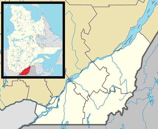
English: Map of southern Québec Province within Canada, for use in location map templates. Français : Carte du sud du Québec. |
| Date | (UTC) |
| Source |
This file was derived from: Canada Quebec location map 2.svg:  |
| Author |
|

|
This locator map image could be re-created using vector graphics as an SVG file. This has several advantages; see Commons:Media for cleanup for more information. If an SVG form of this image is available, please upload it and afterwards replace this template with
{{vector version available|new image name}}.
It is recommended to name the SVG file “Canada Southern Quebec location map.svg”—then the template Vector version available (or Vva) does not need the new image name parameter. |
Licensing
I, the copyright holder of this work, hereby publish it under the following license:
| I, the copyright holder of this work, release this work into the public domain. This applies worldwide. In some countries this may not be legally possible; if so: I grant anyone the right to use this work for any purpose, without any conditions, unless such conditions are required by law. |
Original upload log
This image is a derivative work of the following images:
- File:Canada_Quebec_location_map_2.svg licensed with PD-self
- 2009-09-24T18:30:53Z Hanhil 2316x2822 (2687510 Bytes) {{Information |Description={{en|1=Québec Province within Canada.}} {{es|1=Provincia de Quebec en Canadá.}} |Source=Based on [[:Image:Canada_Quebec_location_map.svg]] |Author=~~~~ based on [[User:EOZyo|EOZyo]] |Date=2009-09-
Uploaded with derivativeFX
File history
Click on a date/time to view the file as it appeared at that time.
| Date/Time | Thumbnail | Dimensions | User | Comment | |
|---|---|---|---|---|---|
| current | 03:42, 2 May 2013 | | 535 × 435 (133 KB) | Gordalmighty | boundary fix |
| 14:46, 1 May 2013 |  | 535 × 435 (132 KB) | Gordalmighty | colour problem | |
| 05:25, 1 May 2013 |  | 535 × 435 (133 KB) | Gordalmighty | uploaded proper file | |
| 04:47, 1 May 2013 |  | 535 × 435 (102 KB) | Gordalmighty | boundary fix | |
| 19:12, 23 April 2013 |  | 520 × 420 (93 KB) | Gordalmighty | localized map to south of Saint Lawrence River & added colour | |
| 00:13, 15 December 2012 |  | 600 × 400 (92 KB) | P199 | == {{int:filedesc}} == {{Information |Description={{en|1=Map of southern Québec Province within Canada, for use in location map templates.}} |Source={{Derived from|Canada_Quebec_location_map_2.svg|display=50}} |Date=2012-12-15 00:12 (UTC) |Author=*[[:... |
File usage
More than 100 pages use this file. The following list shows the first 100 pages that use this file only. A full list is available.
- Abercorn, Quebec
- Acton Vale, Quebec
- Baie-D'Urfé
- Beaconsfield, Quebec
- Beaumont, Quebec
- Bedford, Quebec (town)
- Beloeil, Quebec
- Berthier-sur-Mer
- Boucherville
- Brossard
- Bécancour, Quebec
- Béthanie, Quebec
- Canadian Railway Museum
- Candiac, Quebec
- Carignan, Quebec
- Chambly, Quebec
- Châteauguay
- Coaticook
- Cowansville
- Delson
- Dollard-des-Ormeaux
- Dorval
- Elgin, Quebec
- Farnham, Quebec
- Gare du Palais
- Granby, Quebec
- Greenfield Park, Quebec
- Hampstead, Quebec
- Hinchinbrooke, Quebec
- Hudson, Quebec
- Huntingdon, Quebec
- Kahnawake
- Kanesatake
- Kirkland, Quebec
- L'Islet, Quebec
- L'Île-Dorval
- L'Île-Perrot
- La Prairie, Quebec
- La Présentation, Quebec
- Lac-Mégantic, Quebec
- Laval, Quebec
- Lennoxville, Quebec
- Longueuil
- Lévis
- Magog, Quebec
- Melbourne, Quebec
- Mercier, Quebec
- Mont-Saint-Hilaire
- Montmagny, Quebec
- Montreal Central Station
- Montreal West, Quebec
- Montréal-Est, Quebec
- Mount Royal, Quebec
- North Hatley
- Otterburn Park
- Pincourt
- Pointe-Claire
- Pointe-Fortune, Quebec
- Potton, Quebec
- Richmond, Quebec
- Rigaud, Quebec
- Roxton, Quebec
- Roxton Falls, Quebec
- Saint-Bruno-de-Montarville
- Saint-Charles-sur-Richelieu, Quebec
- Saint-Constant, Quebec
- Saint-Damase-de-L'Islet
- Saint-Denis-sur-Richelieu, Quebec
- Saint-Georges, Quebec
- Saint-Hubert, Quebec
- Saint-Hyacinthe
- Saint-Jean-Port-Joli, Quebec
- Saint-Jean-sur-Richelieu
- Saint-Lambert, Montérégie
- Saint-Lazare, Quebec
- Saint-Liboire
- Saint-Mathieu-de-Beloeil
- Saint-Nazaire-d'Acton, Quebec
- Saint-Simon, Québec
- Saint-Théodore-d'Acton
- Saint-Télesphore
- Sainte-Anne-de-Bellevue
- Sainte-Catherine, Quebec
- Sainte-Christine, Quebec
- Sainte-Hélène-de-Bagot, Quebec
- Sainte-Julie, Quebec
- Sainte-Madeleine, Quebec
- Sainte-Marie-Madeleine, Quebec
- Salaberry-de-Valleyfield
- Senneville, Quebec
- Sherbrooke
- Sorel-Tracy
- Stanstead, Quebec
- Thetford Mines
- Upton, Quebec
- Val-des-Sources
- Varennes, Quebec
- Vaudreuil-Dorion
- Verchères
- Victoriaville
View more links to this file.
Global file usage
The following other wikis use this file:
- Usage on ar.wikipedia.org
- Usage on ca.wikipedia.org
- Usage on ceb.wikipedia.org
- Usage on diq.wikipedia.org
- Usage on el.wikipedia.org
- Usage on es.wikipedia.org
- Usage on eu.wikipedia.org
- Usage on fa.wikipedia.org
- کبک (شهر)
- لاوال، کبک
- آم-نورد، کبک
- سنت-الیزابت-دو-وارویک، کبک
- سنت-کلوتیلد-دو-اورتون، کبک
- کینگسی فالز، کبک
- پاریویل، کبک
- لوونیر، کبک
- سنت-بریژیت-دو-لاوال، کبک
- پلسیویل، کبک (قصبه)
- پیرویل، کبک
- سن-اواریست-دو-فورسیت، کبک
- سن-ژرژ، کبک
- سن-افرم-دو-بوس، کبک
- سن-اینیاس-دو-لویولا، کبک
- سن-ژوزف-ده-ارابل، کبک
- سن-مالو، کبک
- ایست هیرفورد، کبک
- سنت-ارمنژیلد، کبک
- کوتیکوک، کبک
- بارنستون-وست، کبک
- واترویل، کبک
- رپانتینی، کبک
- دیسرائلی، کبک (قصبه)
- ووتون، کبک
- سن-کامی، کبک
- سن-ژرژ-دو-ویندزور، کبک
- اسبستوس، کبک
- سن-اوگوستن-دو-ووبورن، کبک
- لاک-مگانتیک، کبک
- نانت، کبک
- سن-سسیل-دو-ویتون، کبک
- استورنووی، کبک
- راسین، کبک
- سنت-آن-دو-لا-روشل، کبک
- ولکورت، کبک (بخش)
- لا پاتری، کبک
- کوکشایر-ایتون، کبک
- ویدن، کبک
- سن-ادوار-دو-لوتبینییر، کبک
- ستنستید، کبک (شهرک)
- ایرس کلیف، کبک
View more global usage of this file.