Size of this preview: 800 × 598 pixels. Other resolutions: 320 × 239 pixels | 640 × 478 pixels | 1,024 × 765 pixels | 1,280 × 956 pixels | 2,592 × 1,936 pixels.
Original file (2,592 × 1,936 pixels, file size: 2.4 MB, MIME type: image/jpeg)
| This is a file from the Wikimedia Commons. Information from its description page there is shown below. Commons is a freely licensed media file repository. You can help. |
Summary
| Description |
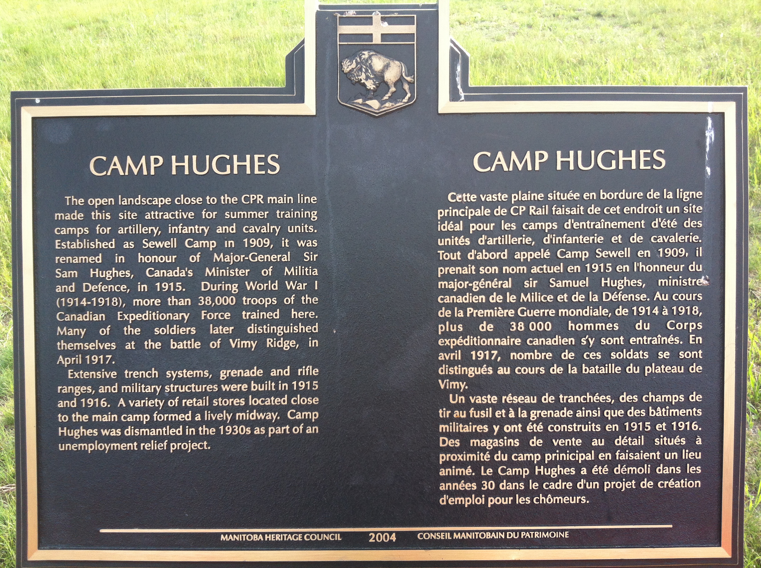
English: A Sign posted near the trenches site at Camp Hughes |
| Date | |
| Source | Camp Hughes |
| Author | JPark99 |
| Camera location | | View this and other nearby images on: OpenStreetMap |
|---|
| This file is made available under the Creative Commons CC0 1.0 Universal Public Domain Dedication. | |
| The person who associated a work with this deed has dedicated the work to the public domain by waiving all of their rights to the work worldwide under copyright law, including all related and neighboring rights, to the extent allowed by law. You can copy, modify, distribute and perform the work, even for commercial purposes, all without asking permission.
|
Licensing
| I, the copyright holder of this work, release this work into the public domain. This applies worldwide. In some countries this may not be legally possible; if so: I grant anyone the right to use this work for any purpose, without any conditions, unless such conditions are required by law. |
File history
Click on a date/time to view the file as it appeared at that time.
| Date/Time | Thumbnail | Dimensions | User | Comment | |
|---|---|---|---|---|---|
| current | 06:24, 20 June 2013 | | 2,592 × 1,936 (2.4 MB) | JPark99 | {{subst:Upload marker added by en.wp UW}} {{Information |Description = {{en|A Sign posted near the trenches site at Camp Hughes}} |Source = Camp Hughes |Date = 2013-06-19 |Author = JPark99 }} {{cc-zero}} |
File usage
The following pages on the English Wikipedia use this file (pages on other projects are not listed):