
Size of this PNG preview of this SVG file: 423 × 599 pixels. Other resolutions: 169 × 240 pixels | 339 × 480 pixels | 542 × 768 pixels | 723 × 1,024 pixels | 1,446 × 2,048 pixels | 894 × 1,266 pixels.
Original file (SVG file, nominally 894 × 1,266 pixels, file size: 625 KB)
| This is a file from the Wikimedia Commons. Information from its description page there is shown below. Commons is a freely licensed media file repository. You can help. |
| Description |
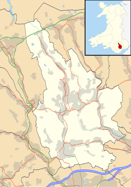
Blank map of Caerphilly, UK with the following information shown:
Equirectangular map projection on WGS 84 datum, with N/S stretched 160% Geographic limits:
|
| Date | |
| Source |
|
| Author | Nilfanion, created using Ordnance Survey data |
| Permission (Reusing this file) |
This file is licensed under the Creative Commons Attribution-Share Alike 3.0 Unported license. Attribution: Contains Ordnance Survey data © Crown copyright and database right
|
| Other versions | File:Caerphilly UK map.svg - Blank map |
File history
Click on a date/time to view the file as it appeared at that time.
| Date/Time | Thumbnail | Dimensions | User | Comment | |
|---|---|---|---|---|---|
| current | 19:28, 26 September 2010 | | 894 × 1,266 (625 KB) | Nilfanion | {{Information |Description=Blank map of Caerphilly, UK with the following information shown: *Administrative borders *Coastline, lakes and rivers *Roads and railways *Urban areas Equirectangular map projection on WGS 84 datum, with N/S st |
File usage
The following pages on the English Wikipedia use this file (pages on other projects are not listed):
- Aber Valley
- Aberbargoed
- Aberbargoed Hospital
- Abercarn
- Abertysswg
- Bargoed
- Bedwas
- Blackwood, Caerphilly
- Bute Town
- Caerphilly
- Caerphilly County Borough
- Caerphilly District Miners Hospital
- Cefn Fforest
- Cefn Mably House
- Crosskeys
- Crumlin, Caerphilly
- Cwmcarn
- Darran Valley
- Deri, Caerphilly
- Draethen
- Fochriw
- Gelligroes Mill
- Graig-y-Rhacca
- Hafodyrynys
- Hengoed
- List of Sites of Special Scientific Interest in Caerphilly
- List of scheduled monuments in Caerphilly County Borough
- Llanbradach
- Machen
- Maesycwmmer
- Markham, Caerphilly
- Morgraig Castle
- Nelson, Caerphilly
- New Tredegar
- Newbridge, Caerphilly
- Oakdale, Caerphilly
- Oakdale Hospital
- Penallta Colliery
- Pengam
- Penmaen, Caerphilly
- Pontllanfraith
- Redwood Memorial Hospital
- Rhymney
- Risca
- Senghenydd
- Tir-Phil
- Trethomas
- Trinant
- Van, Caerphilly
- Welsh Football League Division Two
- Ynysddu
- Ysbyty Ystrad Fawr
- Ystrad Mynach
- Ystrad Mynach Hospital
- Module:Location map/data/Wales Caerphilly
- Module:Location map/data/Wales Caerphilly/doc
Global file usage
The following other wikis use this file:
- Usage on ar.wikipedia.org
- Usage on ceb.wikipedia.org
- Usage on cy.wikipedia.org
- Usage on es.wikipedia.org
- Abercarn
- Wikiproyecto:Ilustración/Taller de Cartografía/Realizaciones/Europa
- Plantilla:Mapa de localización de Caerphilly
- Nelson (Caerphilly)
- Markham (Caerphilly)
- Machen
- Cwmfelinfach
- Llanbradach
- Fochriw
- Deri
- Abertysswg
- Pontlottyn
- Pontllan-fraith
- Pen-twyn
- New Tredegar
- Argoed
- Newbridge (Caerphilly)
- Wattsville
- Ynysddu
- Rhymney
- Abertridwr
- Aberbargoed
- Caerphilly
- Usage on fa.wikipedia.org
- Usage on fr.wikipedia.org
- Usage on gv.wikipedia.org
- Usage on ja.wikipedia.org
- Usage on kn.wikipedia.org
- Usage on pl.wikipedia.org
View more global usage of this file.