File:Brownsville Padre Island Airport Diagram - BRO from Federal Aviation Administration.jpg
Size of this preview: 401 × 599 pixels. Other resolutions: 161 × 240 pixels | 321 × 480 pixels | 754 × 1,126 pixels.
Original file (754 × 1,126 pixels, file size: 182 KB, MIME type: image/jpeg)
| This is a file from the Wikimedia Commons. Information from its description page there is shown below. Commons is a freely licensed media file repository. You can help. |
| Description |
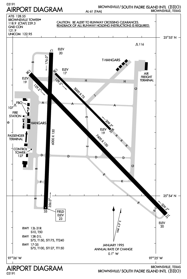
Photos and maps related to Padre Island. Map of Brownsville - Padre Island Airport - Federal Aviation Administrations |
| Date | |
| Source | United States Government (USGS, Dept of Ag, NOAA, NPS, FAA) |
| Author | uploaded by Johntex |
| Permission (Reusing this file) |
Original work of the US Federal Government - public domain |
This image is in the public domain because it contains materials that originally came from the U.S. National Oceanic and Atmospheric Administration, taken or made as part of an employee's official duties.
|
File history
Click on a date/time to view the file as it appeared at that time.
| Date/Time | Thumbnail | Dimensions | User | Comment | |
|---|---|---|---|---|---|
| current | 06:11, 26 June 2006 | | 754 × 1,126 (182 KB) | Johntex~commonswiki | {{Information| |Description=Photos and maps related to Padre Island. Map of Brownsville - Padre Island Airport - Federal Aviation Administrations |Source=United States Government (USGS, Dept of Ag, NOAA, NPS, FAA) |Date=2006-06-26 |Author=uploaded by |
File usage
The following pages on the English Wikipedia use this file (pages on other projects are not listed):
Global file usage
The following other wikis use this file:
- Usage on de.wikipedia.org
- Usage on es.wikipedia.org
- Usage on www.wikidata.org