
Size of this preview: 546 × 600 pixels. Other resolutions: 218 × 240 pixels | 437 × 480 pixels | 793 × 871 pixels.
Original file (793 × 871 pixels, file size: 24 KB, MIME type: image/png)
| This is a file from the Wikimedia Commons. Information from its description page there is shown below. Commons is a freely licensed media file repository. You can help. |
Summary
| Description |
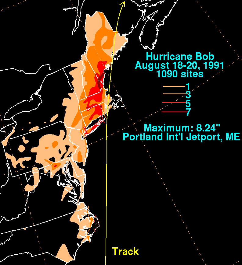
English: Storm total rainfall map of Hurricane Bob during August 1991. |
|||
| Date | ||||
| Source | WPC tropical cyclone rainfall data | |||
| Author | David Roth, Weather Prediction Center, Camp Springs, Maryland | |||
| Permission (Reusing this file) |
|
Original upload log
| Date/Time | Dimensions | User | Comment |
|---|---|---|---|
| 24 April 2010, 15:52:03 | 793 × 871 (28384 bytes) | Cyclonebiskit (talk · contribs) | {{Information |Description={{en|1=The beginnings of this tropical cyclone were along an old frontal boundary southeast of Bermuda on the 12th. Convection increased as it moved southwest and west over the next few days. By the morning of the 15th, a low |
File history
Click on a date/time to view the file as it appeared at that time.
| Date/Time | Thumbnail | Dimensions | User | Comment | |
|---|---|---|---|---|---|
| current | 12:31, 24 August 2014 | | 793 × 871 (24 KB) | GifTagger | Bot: Converting file to superior PNG file. (Source: Bob_1991_rainfall.gif). This GIF was problematic due to non-greyscale color table. |
File usage
The following pages on the English Wikipedia use this file (pages on other projects are not listed):
Global file usage
The following other wikis use this file:
- Usage on sv.wikipedia.org
- Usage on zh.wikipedia.org