Size of this preview: 403 × 600 pixels. Other resolutions: 161 × 240 pixels | 451 × 671 pixels.
Original file (451 × 671 pixels, file size: 55 KB, MIME type: image/png)
| This is a file from the Wikimedia Commons. Information from its description page there is shown below. Commons is a freely licensed media file repository. You can help. |
Summary
| Description |
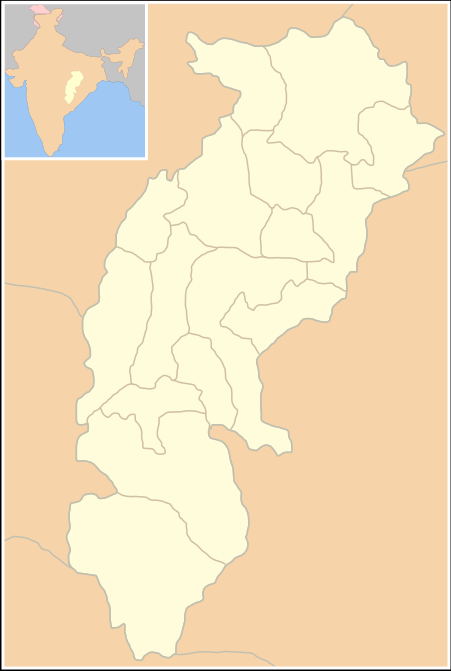
Blank Map: Chhattisgarh State (India) with district boundries - Self Made - w:User:Miljoshi - Jan 2006 Note: co-ordinates are estimated, and may not be exactly accurate. |
| Date | 1 January 2006 (original upload date) |
| Source | No machine-readable source provided. Own work assumed (based on copyright claims). |
| Author | No machine-readable author provided. Miljoshi assumed (based on copyright claims). |
Licensing
I, the copyright holder of this work, hereby publish it under the following licenses:

|
Permission is granted to copy, distribute and/or modify this document under the terms of the GNU Free Documentation License, Version 1.2 or any later version published by the Free Software Foundation; with no Invariant Sections, no Front-Cover Texts, and no Back-Cover Texts. A copy of the license is included in the section entitled GNU Free Documentation License. |
| This file is licensed under the Creative Commons Attribution-Share Alike 3.0 Unported license. | ||
| ||
| This licensing tag was added to this file as part of the GFDL licensing update. |
This file is licensed under the Creative Commons Attribution-Share Alike 2.5 Generic, 2.0 Generic and 1.0 Generic license.
- You are free:
- to share – to copy, distribute and transmit the work
- to remix – to adapt the work
- Under the following conditions:
- attribution – You must give appropriate credit, provide a link to the license, and indicate if changes were made. You may do so in any reasonable manner, but not in any way that suggests the licensor endorses you or your use.
- share alike – If you remix, transform, or build upon the material, you must distribute your contributions under the same or compatible license as the original.
You may select the license of your choice.
File history
Click on a date/time to view the file as it appeared at that time.
| Date/Time | Thumbnail | Dimensions | User | Comment | |
|---|---|---|---|---|---|
| current | 14:02, 1 January 2006 | | 451 × 671 (55 KB) | Miljoshi | Blank Map: Chhattisgarh State (India) with district boundries - Self Made - w:User:Miljoshi - Jan 2006 '''Note: co-ordinates are estimated, and may not be exactly accurate.''' Category:Chhattisgarh district maps |
File usage
More than 100 pages use this file. The following list shows the first 100 pages that use this file only. A full list is available.
- Talk:Ahiwara
- Talk:Ajit Jogi
- Talk:Akaltara
- Talk:Ambagarh Chowki
- Talk:Ambikapur, Chhattisgarh
- Talk:Anupama Bhagwat
- Talk:Arang
- Talk:Bade Bacheli
- Talk:Bagbahara
- Talk:Baikunthpur, Koriya
- Talk:Baliram Kashyap
- Talk:Balod
- Talk:Baloda
- Talk:Baloda Bazar
- Talk:Bastar district
- Talk:Bastar division
- Talk:Bhaiyathan
- Talk:Bhilai
- Talk:Bhilai Institute of Technology
- Talk:Bilaspur, Chhattisgarh
- Talk:Bilaspur Airport
- Talk:Bilaspur district, Chhattisgarh
- Talk:Bilha, India
- Talk:Champaran
- Talk:Champaran, Chhattisgarh
- Talk:Chhattisgarh
- Talk:Chhattisgarh High Court
- Talk:Chhattisgarhi language
- Talk:Chhotanagpur
- Talk:Chota Nagpur Plateau
- Talk:Dandakaranya
- Talk:Dantewada
- Talk:Dantewada district
- Talk:Deori, Bilaspur district
- Talk:Dhamtari
- Talk:Dhamtari district
- Talk:Dilip Singh Judeo
- Talk:Dinesh Nandan Sahay
- Talk:Durg district
- Talk:East Coast Railway zone
- Talk:Ghasidas
- Talk:Gondi people
- Talk:Guharam Ajgalle
- Talk:Hindi
- Talk:Hindi literature
- Talk:India national football team
- Talk:Indravati National Park
- Talk:Indravati River
- Talk:Ingrid Mcleod
- Talk:Jagdalpur
- Talk:Jagdalpur Airport
- Talk:Janjgir–Champa district
- Talk:Jashpur district
- Talk:Jawahar Navodaya Vidyalaya, Basdei
- Talk:Kabirdham district
- Talk:Kanger Valley National Park
- Talk:Kanker district
- Talk:Karuna Shukla
- Talk:Khairagarh
- Talk:Kol people
- Talk:Korba, Chhattisgarh
- Talk:Korba district
- Talk:Korea State
- Talk:Koriya district
- Talk:Krishna Mohan Seth
- Talk:List of chief ministers of Chhattisgarh
- Talk:List of districts of Chhattisgarh
- Talk:List of governors of Chhattisgarh
- Talk:Mahasamund
- Talk:Mahasamund district
- Talk:Mahendra Karma
- Talk:Manendragarh
- Talk:Nand Kumar Sai
- Talk:National Institute of Technology, Raipur
- Talk:Northern dry deciduous forests
- Talk:Patan, Chhattisgarh
- Talk:Pradeep Gandhi
- Talk:Punnulal Mohle
- Talk:Raigarh
- Talk:Raigarh district
- Talk:Raipur
- Talk:Raipur district
- Talk:Rajesh Chauhan
- Talk:Rajnandgaon
- Talk:Rajnandgaon district
- Talk:Raman Singh
- Talk:Ramesh Bais
- Talk:Rihand River
- Talk:Saba Anjum Karim
- Talk:Sakti, Chhattisgarh
- Talk:Sohan Potai
- Talk:Surajpur, Chhattisgarh
- Talk:Surguja district
- Talk:Swami Vivekananda Airport
- Talk:Tarachand Sahu
- Talk:Teejan Bai
- Talk:Vallabha
- Talk:Vidya Charan Shukla
- Talk:Vinod Kumar Shukla
- Talk:Vishnu Deo Sai
View more links to this file.
Global file usage
The following other wikis use this file:
- Usage on id.wikipedia.org