No higher resolution available.
BisdomshertogenboschLocatie.png (270 × 360 pixels, file size: 6 KB, MIME type: image/png)
| This is a file from the Wikimedia Commons. Information from its description page there is shown below. Commons is a freely licensed media file repository. You can help. |
Summary
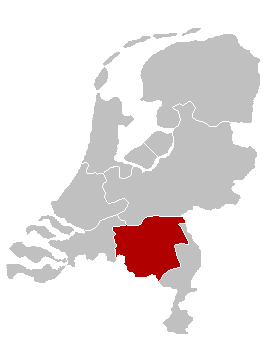
| Description |
English: Map of the Diocese of 's-Hertogenbosch, The Netherlands Nederlands: Kaart van het nl:Bisdom 's-Hertogenbosch |
| Date | 11 June 2005 (original upload date) |
| Source | Originally from nl.wikipedia; description page is/was here. |
| Author |
Original uploader was Karrow at nl.wikipedia English: Adapted from a map by nl:Gebruiker:LennartBolks (see the maps in Category:Religion in the Netherlands): colours changed by nl:Gebruiker:Karrow
Nederlands: Oorspronkelijk gemaakt door nl:Gebruiker:LennartBolks. Kleuren aangepast door nl:Gebruiker:Karrow. |
| Permission (Reusing this file) |
This image is in the public domain. |
Licensing
| |
This work has been released into the public domain by its author, Karrow, at the English Wikipedia project. This applies worldwide. In case this is not legally possible: |
Original upload log
(All user names refer to nl.wikipedia)
- 2005-06-11 09:46 Karrow 270×360×8 (6205 bytes)
File history
Click on a date/time to view the file as it appeared at that time.
| Date/Time | Thumbnail | Dimensions | User | Comment | |
|---|---|---|---|---|---|
| current | 17:08, 26 May 2007 | | 270 × 360 (6 KB) | UV | {{Information |Description={{en|Map of the Diocese of 's-Hertogenbosch, The Netherlands}} {{nl|Kaart van het nl:Bisdom 's-Hertogenbosch}} |Source=Originally from nl.wikipedia; description page is/was [[:nl:Image:BisdomshertogenboschLocatie.p |
File usage
The following pages on the English Wikipedia use this file (pages on other projects are not listed):
Global file usage
The following other wikis use this file:
- Usage on de.wikipedia.org
- Usage on es.wikipedia.org
- Usage on fr.wikipedia.org
- Usage on fy.wikipedia.org
- Usage on id.wikipedia.org
- Usage on it.wikipedia.org
- Usage on jv.wikipedia.org
- Usage on la.wikipedia.org
- Usage on nl.wikipedia.org
- Usage on no.wikipedia.org
- Usage on pl.wikipedia.org
- Usage on ru.wikipedia.org
- Usage on uk.wikipedia.org
- Usage on www.wikidata.org
- Usage on zh.wikipedia.org