
Size of this preview: 800 × 591 pixels. Other resolutions: 320 × 236 pixels | 640 × 472 pixels | 1,024 × 756 pixels | 1,100 × 812 pixels.
Original file (1,100 × 812 pixels, file size: 14 KB, MIME type: image/png)
| This is a file from the Wikimedia Commons. Information from its description page there is shown below. Commons is a freely licensed media file repository. You can help. |
Summary
| Description |
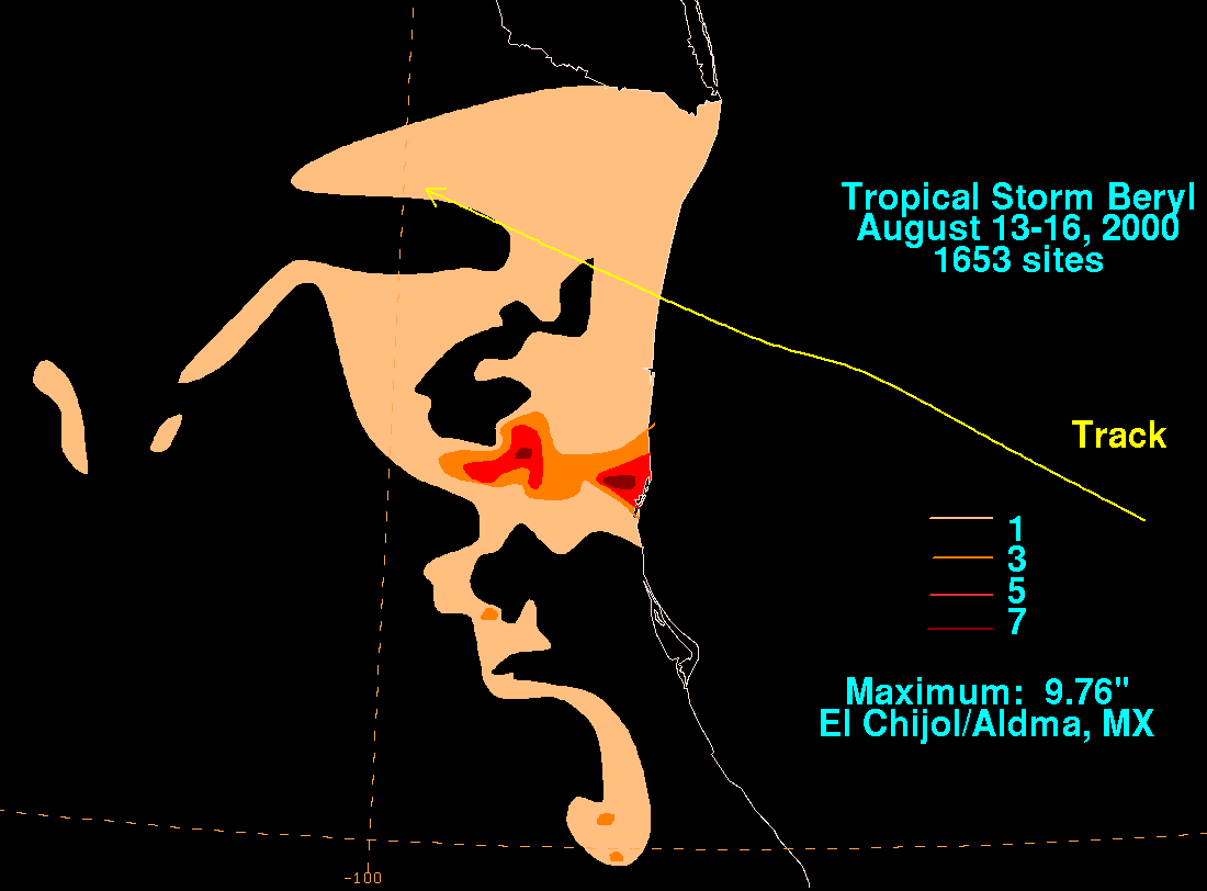
English: Storm total rainfall map of Tropical Storm Beryl during August 2000. |
|||
| Date | ||||
| Source | WPC tropical cyclone rainfall data | |||
| Author | David Roth, Weather Prediction Center, Camp Springs, Maryland | |||
| Permission (Reusing this file) |
|
Original upload log
| Date/Time | Dimensions | User | Comment |
|---|---|---|---|
| 11 April 2009, 08:48:54 | 1100 × 812 (15916 bytes) | Closedmouth (talk · contribs) | {{Information |Description={{en|David Roth Hydrometeorological Prediction Center Camp Springs, MD http://www.hpc.ncep.noaa.gov/tropical/rain/beryl2000filledrainblk.gif}} |Source=Transferred from [http://en.wikipedia.org en.wikipedia]; transfer was stated |
File history
Click on a date/time to view the file as it appeared at that time.
| Date/Time | Thumbnail | Dimensions | User | Comment | |
|---|---|---|---|---|---|
| current | 04:04, 24 August 2014 | | 1,100 × 812 (14 KB) | GifTagger | Bot: Converting file to superior PNG file. (Source: Beryl_2000_rainfall.gif). This GIF was problematic due to non-greyscale color table. |
File usage
The following pages on the English Wikipedia use this file (pages on other projects are not listed):