Size of this preview: 800 × 476 pixels. Other resolutions: 320 × 190 pixels | 640 × 381 pixels | 1,024 × 609 pixels | 1,280 × 761 pixels | 2,355 × 1,401 pixels.
Original file (2,355 × 1,401 pixels, file size: 3.74 MB, MIME type: image/jpeg)
| This is a file from the Wikimedia Commons. Information from its description page there is shown below. Commons is a freely licensed media file repository. You can help. |
Summary
| Description |
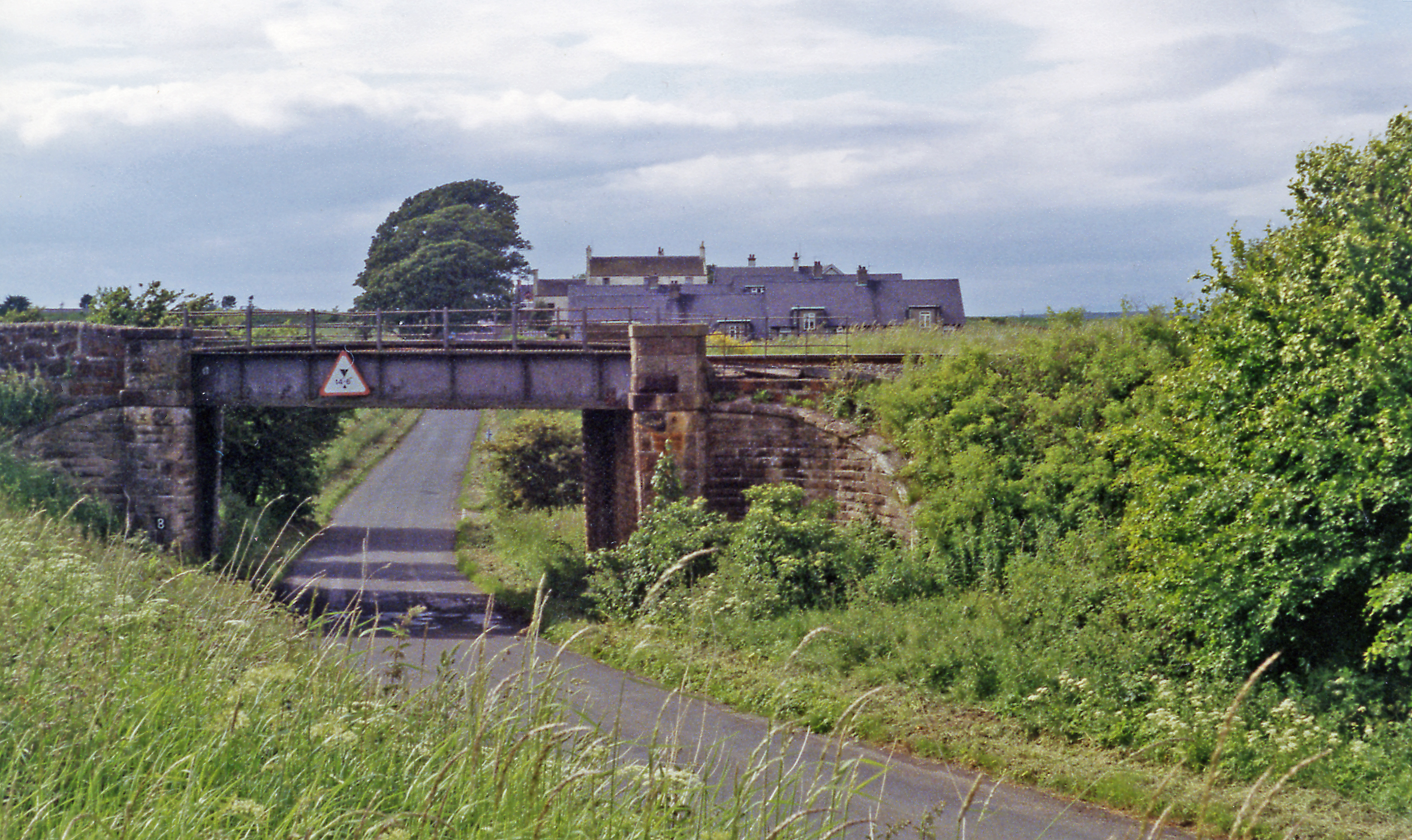
English: Site of Auchincruive station, 1994. View SE from the A758, to the bridge where the ex-GSWR Ayr (to left) - Annbank (to right) - Drongan - Muirkirk line crosses. The station, which was up on the left, had been closed to passengers on 10/9/51 when the service (via Drongan) ceased, but the line was still open - for open-cast coal. |
| Date | |
| Source | From geograph.org.uk |
| Author | Ben Brooksbank |
| Permission (Reusing this file) |
Creative Commons Attribution Share-alike license 2.0 |
| Attribution (required by the license) | Ben Brooksbank / Site of Auchincruive station, 1994 / |
| Camera location | | View this and other nearby images on: OpenStreetMap |
|---|
Licensing

|
This image was taken from the Geograph project collection. See this photograph's page on the Geograph website for the photographer's contact details. The copyright on this image is owned by Ben Brooksbank and is licensed for reuse under the Creative Commons Attribution-ShareAlike 2.0 license.
|
This file is licensed under the Creative Commons Attribution-Share Alike 2.0 Generic license.
Attribution: Ben Brooksbank
- You are free:
- to share – to copy, distribute and transmit the work
- to remix – to adapt the work
- Under the following conditions:
- attribution – You must give appropriate credit, provide a link to the license, and indicate if changes were made. You may do so in any reasonable manner, but not in any way that suggests the licensor endorses you or your use.
- share alike – If you remix, transform, or build upon the material, you must distribute your contributions under the same or compatible license as the original.
File history
Click on a date/time to view the file as it appeared at that time.
| Date/Time | Thumbnail | Dimensions | User | Comment | |
|---|---|---|---|---|---|
| current | 12:18, 18 December 2012 | | 2,355 × 1,401 (3.74 MB) | Chevin | == {{int:filedesc}} == {{Information |Description={{en|1='''Site of Auchincruive station, 1994.'''<br/> View SE from the A758, to the bridge where the ex-GSWR Ayr (to left) - Annbank (to right) - Drongan - Muirkirk line crosses. The station, which was ... |
File usage
The following pages on the English Wikipedia use this file (pages on other projects are not listed):
Global file usage
The following other wikis use this file:
- Usage on arz.wikipedia.org
- Usage on www.wikidata.org