Original file (800 × 1,004 pixels, file size: 175 KB, MIME type: image/jpeg)
Summary edit
| Description |
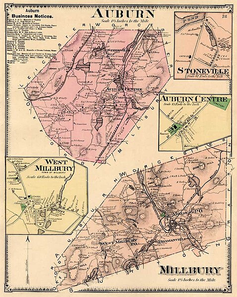
Hand-colored map of Auburn and Millbury, Massachusetts |
|---|---|
| Source |
Reproduced from F. W. Beers' Atlas of Worcester County, Massachusetts |
| Date |
1870 |
| Author |
Based on surveys by F. W. Beers and George P. Sanford, engraved by Louis Neuman and lithographed by Charles Hart |
| Permission (Reusing this file) |
Copyright expired as publication of map pre-dates 1923 -- see below
|
Licensing edit
| This image is in the public domain in the United States. In most cases, this means that it was first published prior to January 1, 1929 (see the template documentation for more cases). Other jurisdictions may have other rules, and this image might not be in the public domain outside the United States. See Wikipedia:Public domain and Wikipedia:Copyrights for more details. |
 | This file is a candidate to be copied to Wikimedia Commons.
Any user may perform this transfer; refer to Wikipedia:Moving files to Commons for details. If this file has problems with attribution, copyright, or is otherwise ineligible for Commons, then remove this tag and DO NOT transfer it; repeat violators may be blocked from editing. Other Instructions
| ||
| |||
| This media file is either in the public domain or published under a free license, and contains no inbound file links. If this media file is useful, then it should be transferred to the Wikimedia Commons. If this media is not useful, then please propose it for deletion or list it at files for discussion. |
File history
Click on a date/time to view the file as it appeared at that time.
| Date/Time | Thumbnail | Dimensions | User | Comment | |
|---|---|---|---|---|---|
| current | 17:49, 9 December 2006 |  | 800 × 1,004 (175 KB) | Chuckyg80s (talk | contribs) | Hand-colored map, from F. W. Beers' Atlas of Worcester County Massachusetts, published 1870. Based on surveys by Beers and George P. Sanford, engraved by Louis Neuman and lithographed by Charles Hart. |
You cannot overwrite this file.