
Size of this preview: 341 × 599 pixels. Other resolutions: 136 × 240 pixels | 352 × 618 pixels.
Original file (352 × 618 pixels, file size: 38 KB, MIME type: image/png)
| This is a file from the Wikimedia Commons. Information from its description page there is shown below. Commons is a freely licensed media file repository. You can help. |
Summary
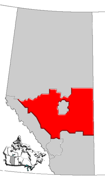
| Description | Map of Central Alberta, Canada |
| Date | |
| Source | GIS data |
| Author | Qyd (talk · contribs) |
| Permission (Reusing this file) |
All |
Licensing
| I, the copyright holder of this work, release this work into the public domain. This applies worldwide. In some countries this may not be legally possible; if so: I grant anyone the right to use this work for any purpose, without any conditions, unless such conditions are required by law. |
File history
Click on a date/time to view the file as it appeared at that time.
| Date/Time | Thumbnail | Dimensions | User | Comment | |
|---|---|---|---|---|---|
| current | 16:19, 4 January 2007 | | 352 × 618 (38 KB) | Qyd | {{Information |Description=Map of Central Alberta, Canada |Source=GIS data |Date=Jan 2006 |Author={{User|Qyd}} |Permission=All |other_versions= }} Category:Maps of Alberta |
File usage
More than 100 pages use this file. The following list shows the first 100 pages that use this file only. A full list is available.
- Abee
- Abraham Lake
- Alcomdale
- Alcurve, Alberta
- Alder Flats
- Alhambra, Alberta
- Alpen, Alberta
- Alsike, Alberta
- Amisk River
- Ansell, Alberta
- Ardley, Alberta
- Armena
- Battle Lake (Alberta)
- Beach Corner, Alberta
- Bearberry, Alberta
- Beauvallon, Alberta
- Beaver Crossing, Alberta
- Beaverdam, Alberta
- Beaverhill Lake
- Bellis, Alberta
- Bergen, Alberta
- Betula Beach
- Birch Cove
- Birchcliff
- Blue Ridge, Alberta
- Bonnie Lake (Alberta)
- Brazeau Reservoir
- Bruce (Alberta provincial electoral district)
- Brûlé Lake (Alberta)
- Buffalo Lake (Alberta)
- Burnstick Lake
- Busby, Alberta
- Canyon Ski Area
- Castle Island, Alberta
- Central Alberta
- Cereal, Alberta
- Cherhill, Alberta
- Chip Lake (Alberta)
- Coal Lake (Alberta)
- Compeer, Alberta
- Condor, Alberta
- Crystal Springs, Alberta
- Dewberry, Alberta
- Division No. 8, Alberta
- Edberg, Alberta
- Edgerton, Alberta
- Erskine, Alberta
- Gough Lake
- Grandview, Alberta
- Gunn, Alberta
- Half Moon Bay, Alberta
- Hoselaw, Alberta
- Jarvis Bay
- Kirriemuir, Alberta
- Lac la Biche (Alberta)
- Larkspur, Alberta
- Lea Park, Alberta
- Leslieville, Alberta
- Luscar, Alberta
- MacKay, Alberta
- Marlboro, Alberta
- Mercoal, Alberta
- Morningside, Alberta
- Mountain Park, Alberta
- Nakamun Park
- Nevis, Alberta
- Niton Junction
- Norglenwold
- Norris Beach
- Obed, Alberta
- Onion Lake Cree Nation
- Parkland Beach, Alberta
- Peers, Alberta
- Pelican Narrows, Alberta
- Phoenix, Alberta
- Pine Lake, Alberta
- Pine Shadows, Alberta
- Pinedale, Alberta
- Pipestone Creek
- Red Deer Lake (Alberta)
- Red Willow, Alberta
- Rochfort Bridge
- Rochon Sands
- Round Hill, Alberta
- Sandy Beach, Alberta
- Silver Sands, Alberta
- Silver Summit, Alberta
- South View, Alberta
- Spruce View
- Star, Alberta
- Stirlingville, Alberta
- Sunset Point, Alberta
- Sylvan Lake (Alberta)
- Tawatinaw
- Val Quentin
- Villeneuve, Alberta
- Warspite, Alberta
- Water Valley, Alberta
- West Cove
- White Sands, Alberta
View more links to this file.
Global file usage
The following other wikis use this file:
- Usage on de.wikipedia.org
- Usage on en.wikivoyage.org
- Usage on fa.wikipedia.org
- Usage on it.wikipedia.org
- Usage on pt.wikipedia.org
- Usage on simple.wikipedia.org
- Usage on www.wikidata.org