.jpg)
.jpg&action=edit&redlink=1)

Size of this preview: 800 × 339 pixels. Other resolutions: 320 × 135 pixels | 640 × 271 pixels | 1,024 × 433 pixels | 1,280 × 542 pixels | 2,560 × 1,083 pixels | 8,175 × 3,460 pixels.
Original file (8,175 × 3,460 pixels, file size: 20.22 MB, MIME type: image/jpeg)
| This is a file from the Wikimedia Commons. Information from its description page there is shown below. Commons is a freely licensed media file repository. You can help. |
.jpg)
Summary
| Description |
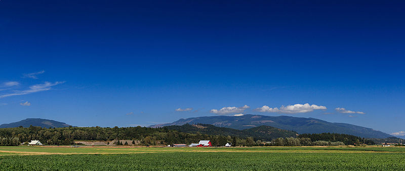
I stitched several photos together—well, let’s be fair; Lightroom did the stitching—in an attempt to capture the awesome beauty of the area and the bright red farm nestled near Lyman Hill. You can see the farm in Google Earth at this link: goo.gl/maps/FDL6E |
| Date | |
| Source | A Farm in Burlington |
| Author | David Hepworth from Bartlesville, USA |
| Camera location | | View this and other nearby images on: OpenStreetMap |
|---|
.jpg¶ms=048.521720_N_-122.347784_E_globe:Earth_type:camera_source:Flickr_&language=en)
Licensing
This file is licensed under the Creative Commons Attribution 2.0 Generic license.
- You are free:
- to share – to copy, distribute and transmit the work
- to remix – to adapt the work
- Under the following conditions:
- attribution – You must give appropriate credit, provide a link to the license, and indicate if changes were made. You may do so in any reasonable manner, but not in any way that suggests the licensor endorses you or your use.
| This image was originally posted to Flickr by DHPersonal at https://flickr.com/photos/18251420@N00/20637525449. It was reviewed on 24 August 2015 by FlickreviewR and was confirmed to be licensed under the terms of the cc-by-2.0. |
File history
Click on a date/time to view the file as it appeared at that time.
| Date/Time | Thumbnail | Dimensions | User | Comment | |
|---|---|---|---|---|---|
| current | 04:22, 24 August 2015 | | 8,175 × 3,460 (20.22 MB) | ויקיג'אנקי | Transferred from Flickr via Flickr2Commons |
File usage
No pages on the English Wikipedia use this file (pages on other projects are not listed).
.jpg)