Size of this preview: 800 × 535 pixels. Other resolutions: 320 × 214 pixels | 640 × 428 pixels | 1,024 × 685 pixels | 1,184 × 792 pixels.
Original file (1,184 × 792 pixels, file size: 449 KB, MIME type: image/jpeg)
| This is a file from the Wikimedia Commons. Information from its description page there is shown below. Commons is a freely licensed media file repository. You can help. |
Summary
| Description |
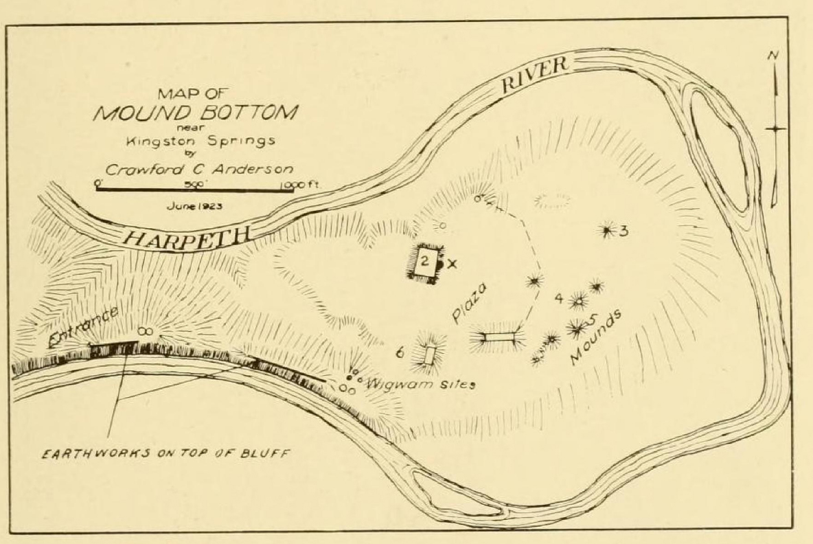
English: Map of the w:Mound Bottom archaeological site in w:Cheatham County, Tennessee, prepared in 1923 by Crawford C. Anderson. Originally published as Figure 109 by William Edward Myer in "Archaeological Field Work in Tennessee" (Smithsonian Miscellaneous Collections 76-1. Washington, DC: Smithsonian Institution, 1924) |
| Date | |
| Source | https://archive.org/details/cbarchive_48626_archaeologicalfieldworkintenne1862 |
| Author | William Edward Myer |
Licensing
This work is in the public domain in the United States because it was published (or registered with the U.S. Copyright Office) before January 1, 1929.
Public domain works must be out of copyright in both the United States and in the source country of the work in order to be hosted on the Commons. If the work is not a U.S. work, the file must have an additional copyright tag indicating the copyright status in the source country.
Note: This tag should not be used for sound recordings. |
File history
Click on a date/time to view the file as it appeared at that time.
| Date/Time | Thumbnail | Dimensions | User | Comment | |
|---|---|---|---|---|---|
| current | 01:42, 21 May 2023 | | 1,184 × 792 (449 KB) | BD2412 | Restore full-size PD version. |
| 06:11, 30 January 2017 |  | 386 × 258 (25 KB) | Theo's Little Bot | Reduce size of non-free image (BOT - disable) | |
| 15:03, 16 September 2016 |  | 1,184 × 792 (449 KB) | Wallace63 | Uploading an excerpt from a non-free work using File Upload Wizard |
File usage
The following pages on the English Wikipedia use this file (pages on other projects are not listed):