El Cajon Boulevard is a major east–west thoroughfare through San Diego, La Mesa and El Cajon, California. Before the creation of Interstate 8 it was the principal automobile route from San Diego to El Cajon, the Imperial Valley, and points east as U.S. Route 80; it is now signed as a business loop of Interstate 8.
 El Cajon Boulevard near west end | |
| Part of | |
|---|---|
| Location | San Diego County, California (San Diego, La Mesa, El Cajon) |
| Coordinates | 32°45′18.77″N 117°8′45.46″W / 32.7552139°N 117.1459611°W to 32°46′14.57″N 117°1′18.78″W / 32.7707139°N 117.0218833°W and 32°46′57.5″N 116°58′47.45″W / 32.782639°N 116.9798472°W to 32°47′41.53″N 116°58′2.95″W / 32.7948694°N 116.9674861°W[1] |
| West end | Normal Street in San Diego[2] |
| Major junctions | [2] |
| East end | Main Street in La Mesa[2] |
Route description edit
The boulevard now consists of two disconnected portions, one in San Diego and La Mesa, and the other in El Cajon. The central section through La Mesa's Grossmont Pass was built over by Interstate 8.

History edit
It was formerly part of U.S. Route 80, and became a business loop for Interstate 8 when U.S. Route 80 was decommissioned and replaced by the interstate.[3] It is designated as a historic highway by the state of California.[4] Only portions of what would become El Cajon Boulevard in both La Mesa and El Cajon were originally part of US 80. During a re-routing through San Diego onto Park Boulevard in 1929, the western portion of El Cajon Boulevard was added to US 80. The next section of El Cajon Boulevard added to US 80 was between La Mesa and El Cajon around 1940. Today, most of the route from La Mesa to El Cajon has been overlaid by I-8. The final part of El Cajon Boulevard to receive the US 80 designation was a small piece between Park Boulevard and Normal Street in the late 1940s early 1950s when US 80 was re-routed off Park Boulevard onto the new Cabrillo Freeway.[2] US 80 ceased to exist legislatively within California after July 1, 1964.[5]
It has been cited as a prime example of a commercial strip whose growth and development was shaped by the automobile, as opposed to the parallel University Avenue commercial strip whose growth was shaped by the trolley.[6] Since El Cajon Boulevard was formerly the major route east from San Diego, there are many old hotels and motels on it. One of them, the Lafayette Hotel, is of considerable historic interest.[7]
The first Jack in the Box restaurant was opened at 6270 El Cajon Boulevard by Robert O. Peterson in 1951.[8][9] The site had originally been a drive-in diner called "Topsy's", later renamed "Oscar's" after Peterson's middle name, which was a classic drive-in where food was served by carhops to patrons in the parking lot. Jack in the Box was the first drive-through, with the innovation of a two-way intercom that allowed one car to place an order while another car was being served. Other restaurants had previously offered drive-up window service, but Jack in the Box was the first major chain to make drive-through windows the focus of its operation.[10]
The street was the site of the El Cajon Boulevard Riot in August 1960, also known as the Drag Strip Riot,[11] considered one of the first major youth riots of the 1960s. In the latter part of the 20th century, El Cajon Boulevard developed an unsavory reputation as a hotspot for prostitution.[12]
On June 6, 1963, President John F. Kennedy rode in an open "bubble car" in a motorcade headed east on El Cajon Boulevard on his way to give a commencement speech and receive an honorary degree at San Diego State College.[13][14]
In 2015, a state of the art new YMCA facility at the intersection with Fairmount Road opened up on land donated by philanthropist Robert Price. Dedicated to serving community members in City Heights, Talmadge and Kensington, disparate economic, ethnic and cultural differences of people who live on either side of El Cajon Boulevard were exposed.[15][16]
In 2020, a dedicated bus-only lane intended to improve traffic congestion and increase public transportation use was established as part of San Diego's "Climate Action Plan" along three miles of the Boulevard in 2020.[17][18]
Business Districts edit
The El Cajon Boulevard Business Improvement Association was formed in 1988[19] to improve physical and economic conditions along the 60 blocks of the boulevard between Park Boulevard and 54th Street. The association installed a large "The Boulevard" sign (see photo) to document the street's importance.
The College Area Business District was formed in 1996 and covered the area east of 54th Street to 73rd Street in La Mesa.[20] They hosted the annual Halloween "Boulevard BOO! parade" on the Boulevard in Rolando from 2004 to 2019.[21]
A six-block section from Euclid to Highland avenues was officially designated the Little Saigon Cultural and Commercial District in 2013. The mission of the Little Saigon San Diego Foundation is to "revitalize the densely populated Vietnamese business district of El Cajon Boulevard."[22]
Major intersections edit
The entire route is in San Diego County.
| Location | mi[23] | km | Destinations | Notes | |||
|---|---|---|---|---|---|---|---|
| San Diego | 0.00 | 0.00 | Park Boulevard / Normal Street | Western terminus | |||
| 1.2 | 1.9 | I-805 exit 16 | |||||
| 2.1 | 3.4 | SR 15 exit 5B; future I-15 | |||||
| La Mesa | 7.2 | 11.6 | |||||
| 7.3– 7.5 | 11.7– 12.1 | Center Street | Interchange; no eastbound exit | ||||
| 7.6 | 12.2 | West end of I-8 overlap; I-8 exit 13A | |||||
| Overlap with I-8 | |||||||
| El Cajon | 10.0 | 16.1 | East end of I-8 overlap; no westbound access to I-8 east; I-8 exit 15 | ||||
| 11.3 | 18.2 | Main Street / Douglas Avenue – Downtown | Eastern terminus | ||||
1.000 mi = 1.609 km; 1.000 km = 0.621 mi
| |||||||
Points of interest edit
- Blessed Sacrament Catholic Church, corner of El Cerrito Drive
- Chicken Pie Shop, 2633 El Cajon Blvd[24]
- Hoover High School, 4474 El Cajon Blvd
- The Lafayette Hotel, Swim Club & Bungalows, 2223 El Cajon Blvd
- North Park Water Tower, at North Park Community Park
- San Diego Center for the Blind, 5922 El Cajon Blvd
- Rudford's Restaurant, 2900 El Cajon Blvd[25]
- Copley Price YMCA, 4300 El Cajon Blvd
Gallery edit
-
 Photo mural of 1963 JFK Motorcade on El Cajon Boulevard with Rudford's in Background. The mural is on the west side of Rudford's restaurant as of 2023.
 -
 Rudford's Restaurant in 2023
 -
 Historic Campus Drive-In Theater at intersection with College Avenue
 -
 Lafayette Hotel in North Park
 -
 Blessed Sacrament Catholic Church: College Area Business District signs hang from the streetlight in front.
 -
 North Park Water Tower
 -
 San Diego Center for the Blind
 -
 Chicken Pie Shop
 -
 El Cajon Boulevard Business Improvement District Offices
 -

-
 Woodrow Wilson Middle School in North Park
 -
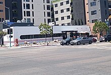
 Boulevard Transit Plaza at the intersection of I-15.
 -
 215 Rapid Bus Stop - Marked stops on El Cajon Boulevard include College Avenue, 54th Street, Winona Avenue, 43rd Street, Boulevard Transit Plaza, 35th Street, 30th Street, and Texas Street.
 -
![The former Andrew Jackson Post Office, 6401 El Cajon Boulevard[26]](//upload.wikimedia.org/wikipedia/commons/thumb/c/ca/Andrew_Jackson_Station_Post_Office_-_Rolando%2C_San_Diego.jpg/135px-Andrew_Jackson_Station_Post_Office_-_Rolando%2C_San_Diego.jpg) The former Andrew Jackson Post Office, 6401 El Cajon Boulevard[26]
The former Andrew Jackson Post Office, 6401 El Cajon Boulevard[26]


![The former Andrew Jackson Post Office, 6401 El Cajon Boulevard[26]](/wiki/File:Andrew_Jackson_Station_Post_Office_-_Rolando,_San_Diego.jpg)
References edit
- ^ "geolocator". Retrieved 6 October 2014.
- ^ a b c d Jensen, Jeff (2013). Drive the Broadway of America!. Tucson, Arizona: Bygone Byways. pp. Pages 216 and 217. ISBN 9780978625900.
- ^ "East on El Cajon Boulevard from 43rd, San Diego". SDSUnbound. Archived from the original on 2023-06-28. Retrieved 2023-06-28.
- ^ "Historic Highway 80 - El Cajon Boulevard". TheBoulevard.org. Archived from the original on 6 October 2014. Retrieved 6 October 2014.
- ^ Weingroff, Richard F. (October 17, 2013). "U.S. Route 80: The Dixie Overland Highway". Highway History. Federal Highway Administration. Retrieved April 1, 2015.
- ^ O'Connor-Ruth, Anne V. "Mercantile to MacDonald's: Commercial Strips in San Diego". The Journal of San Diego History. 38 (3). Archived from the original on 2001-07-11 – via San Diego Historical Society.
- ^ "LaFayette Hotel & Suites". Retrieved 6 October 2014.
- ^ "Jack in the Box Corporate - Corporate Profile - History - History". Jack in the Box. Archived from the original on 2009-10-17. Retrieved 2023-07-13.
- ^ "San Diego Historical Society timeline". San Diego History Center. Archived from the original on 2004-02-05. Retrieved 6 October 2014.
- ^ Langdon, Philip, Orange Roofs, Golden Arches: The architecture of American chain restaurants, page 104, Knopf, 1986, ISBN 978-0-394-54401-4
- ^ Williams, Gregory L. (Spring–Summer 1998). "GUIDE TO THE PHOTOGRAPH COLLECTIONS OF THE SAN DIEGO HISTORICAL SOCIETY". The Journal of San Diego History. 44 (2). Archived from the original on 2003-08-04 – via San Diego Historical Society.
- ^ Kyle, Keegan (2009-10-07). "Voice of San Diego, March 25, 2010". Voice of San Diego. Archived from the original on 2009-12-18. Retrieved 6 October 2014.
- ^ Carroll, John (2023-06-07). "60th anniversary of President Kennedy's trip to San Diego". KPBS Public Media. Retrieved 2023-06-28.
- ^ Dotinga, Randy (2010-09-16). "Did JFK Really Think Route 163 Was Awesome?". Voice of San Diego. Retrieved 2023-06-28.
- ^ Jennewein, Chris (2015-01-27). "New Copley-Price Family YMCA Opened in Mid-City". Times of San Diego. Retrieved 2023-06-28.
- ^ Florido, Adrian (2011-07-05). "A Culture Clash Where Three Neighborhoods Meet". Voice of San Diego. Retrieved 2023-06-28.
- ^ Stone, Ken (2020-01-08). "El Cajon Boulevard Gets New Stretch of Dedicated Bus Lane to Speed Service". Times of San Diego. Retrieved 2023-06-28.
- ^ McFadden, Kris; Gomez, Georgette; Ward, Chris (2019-05-08). "Pilot Program for Bus-Only Lane on El Cajon Boulevard" (PDF). SanDiego.gov.
- ^ "The BIA". The Boulevard BIA. Retrieved 2023-06-28.
- ^ "About Us – College Area Business District". Retrieved 2023-06-28.
- ^ "Boulevard BOO! Parade & Carnival". Archived from the original on 2009-01-07.
- ^ "Our History – Little Saigon". Archived from the original on 2020-07-24. Retrieved 2020-09-23.
- ^ "Overview of El Cajon Boulevard". Google Maps. Google, Inc. Retrieved September 23, 2019.
- ^ Cohen, Ariana (April 25, 2023). "San Diego's Chicken Pie Shop to remodel for its 85th anniversary". cbs8.com. Retrieved 2023-07-27.
- ^ "The legends: SD's oldest restaurants". San Diego Union-Tribune. 2013-07-10. Retrieved 2023-07-27.
- ^ Sullivan Brennan, Deborah (2023-07-07). "Rolando post office renamed for longtime San Diego lawmaker Susan Davis". San Diego Union-Tribune. Retrieved 2024-03-02.