50th Street station (BMT West End Line)
The 50th Street station is a local station on the BMT West End Line of the New York City Subway, located at the intersection of 50th Street and New Utrecht Avenue in Borough Park, Brooklyn. It is served by the D train at all times. The station opened in 1916, and had its platforms extended in the 1960s.
50 Street | ||||||||||||||||||||||||||||||||||||||||||||||||||||||||||||||||||||
|---|---|---|---|---|---|---|---|---|---|---|---|---|---|---|---|---|---|---|---|---|---|---|---|---|---|---|---|---|---|---|---|---|---|---|---|---|---|---|---|---|---|---|---|---|---|---|---|---|---|---|---|---|---|---|---|---|---|---|---|---|---|---|---|---|---|---|---|---|
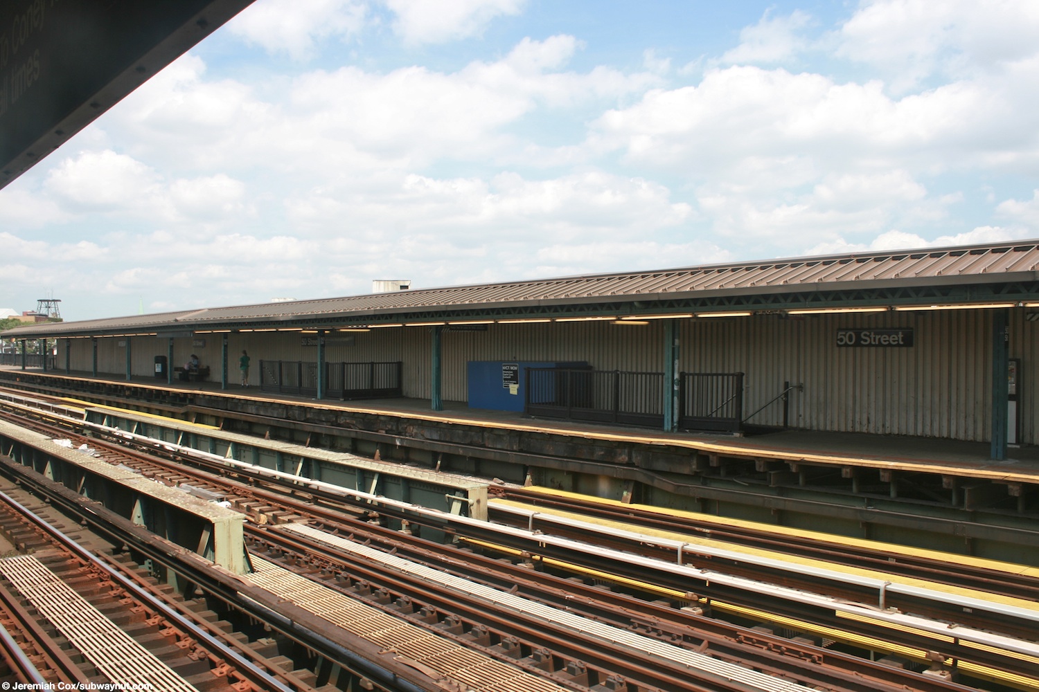
 View of the Brooklyn-bound platform | ||||||||||||||||||||||||||||||||||||||||||||||||||||||||||||||||||||
| Station statistics | ||||||||||||||||||||||||||||||||||||||||||||||||||||||||||||||||||||
| Address | 50th Street & New Utrecht Avenue Brooklyn, NY 11219 | |||||||||||||||||||||||||||||||||||||||||||||||||||||||||||||||||||
| Borough | Brooklyn | |||||||||||||||||||||||||||||||||||||||||||||||||||||||||||||||||||
| Locale | Borough Park | |||||||||||||||||||||||||||||||||||||||||||||||||||||||||||||||||||
| Coordinates | 40°38′10″N 73°59′42″W / 40.63611°N 73.99498°W | |||||||||||||||||||||||||||||||||||||||||||||||||||||||||||||||||||
| Division | B (BMT)[1] | |||||||||||||||||||||||||||||||||||||||||||||||||||||||||||||||||||
| Line | BMT West End Line | |||||||||||||||||||||||||||||||||||||||||||||||||||||||||||||||||||
| Services | D | |||||||||||||||||||||||||||||||||||||||||||||||||||||||||||||||||||
| Transit | ||||||||||||||||||||||||||||||||||||||||||||||||||||||||||||||||||||
| Structure | Elevated | |||||||||||||||||||||||||||||||||||||||||||||||||||||||||||||||||||
| Platforms | 2 side platforms | |||||||||||||||||||||||||||||||||||||||||||||||||||||||||||||||||||
| Tracks | 3 (2 in regular service) | |||||||||||||||||||||||||||||||||||||||||||||||||||||||||||||||||||
| Other information | ||||||||||||||||||||||||||||||||||||||||||||||||||||||||||||||||||||
| Opened | June 24, 1916 | |||||||||||||||||||||||||||||||||||||||||||||||||||||||||||||||||||
| Opposite- direction transfer | Yes | |||||||||||||||||||||||||||||||||||||||||||||||||||||||||||||||||||
| Traffic | ||||||||||||||||||||||||||||||||||||||||||||||||||||||||||||||||||||
| 2023 | 753,338[2] | |||||||||||||||||||||||||||||||||||||||||||||||||||||||||||||||||||
| Rank | 341 out of 423[2] | |||||||||||||||||||||||||||||||||||||||||||||||||||||||||||||||||||
| ||||||||||||||||||||||||||||||||||||||||||||||||||||||||||||||||||||
| ||||||||||||||||||||||||||||||||||||||||||||||||||||||||||||||||||||
| ||||||||||||||||||||||||||||||||||||||||||||||||||||||||||||||||||||
| ||||||||||||||||||||||||||||||||||||||||||||||||||||||||||||||||||||
| ||||||||||||||||||||||||||||||||||||||||||||||||||||||||||||||||||||


History edit
50th Street station opened on June 24, 1916, along with the first portion of the BMT West End Line from 36th Street on the BMT Fourth Avenue Line to 18th Avenue station.[3][4] The line was originally a surface excursion railway to Coney Island, called the Brooklyn, Bath and Coney Island Railroad, which was established in 1862, but did not reach Coney Island until 1864.[5] Under the Dual Contracts of 1913, an elevated line was built over New Utrecht Avenue, 86th Street and Stillwell Avenue.[6][7][8]
The platforms at the station were extended in the 1960s to 615 feet (187 m) to accommodate ten-car trains.[citation needed]
Station layout edit
| Platform level | Side platform | |
| Northbound local | ← | |
| Peak-direction express | No regular service | |
| Southbound local | | |
| Side platform | ||
| Mezzanine | Fare control, station agent, MetroCard machines | |
| Ground | Street level | Entrance/exit |

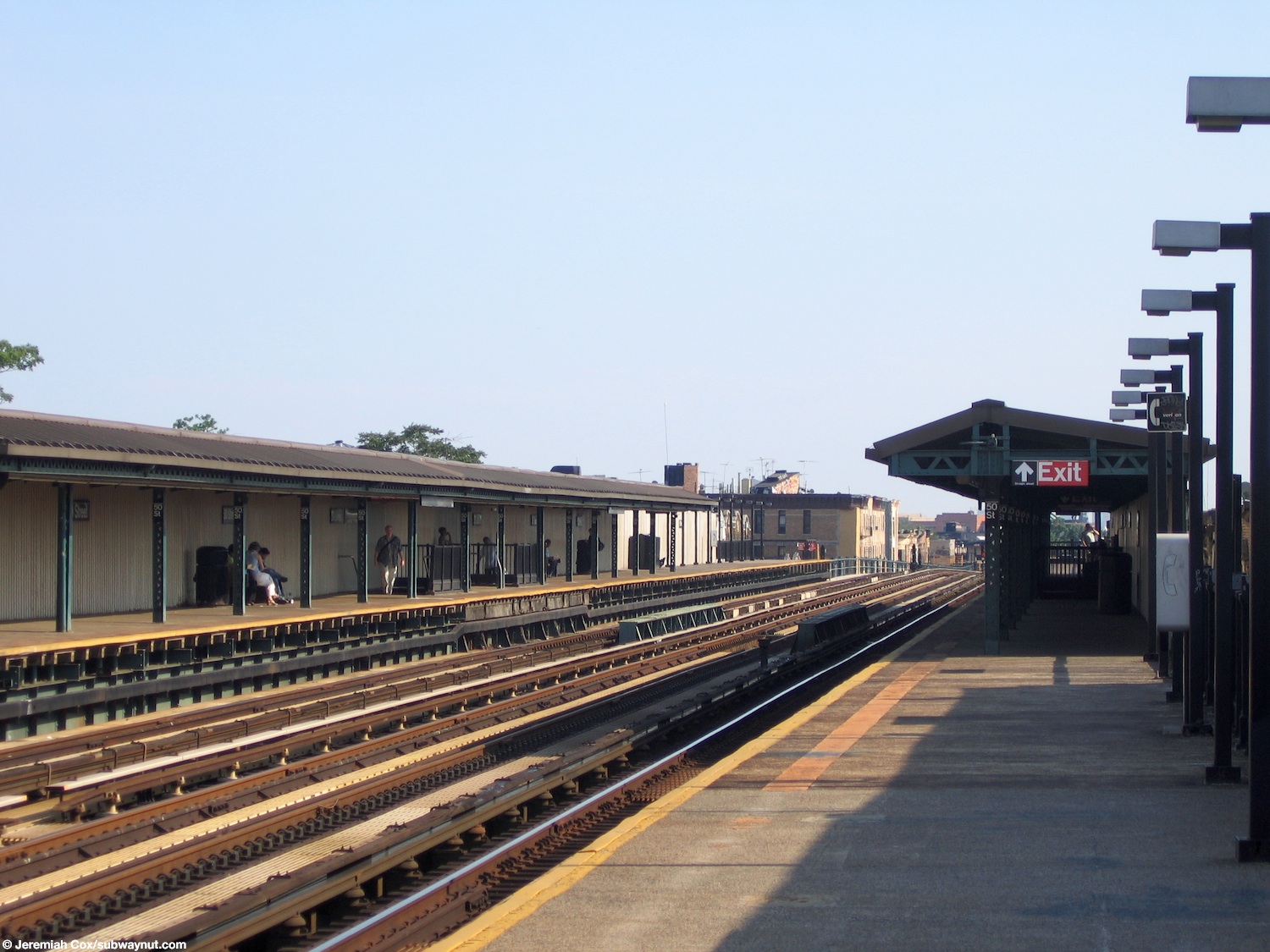
This elevated station has three tracks and two side platforms. The D train stops here at all times, and the center express track is not normally used in service.[9][10]
The platforms have beige windscreens and brown canopies with green frames at their center and waist-high black steel fences at either end.[11][12] They are offset; the Manhattan-bound platform is more to the north than the Coney Island-bound one and both have electrical distribution rooms at either end.
Exits edit
The station's only entrance is via an elevated station house beneath the tracks that has four street stairs, two to either side of New Utrecht Avenue between 49th and 50th Streets. The station house has cherry red doors, a clad wood trim exterior, and beige interior. There are also glass block windows and heaters. The fare control consists of a token booth, turnstile bank, waiting area and two staircases to each platform at their center.[13]
References edit
- ^ "Glossary". Second Avenue Subway Supplemental Draft Environmental Impact Statement (SDEIS) (PDF). Vol. 1. Metropolitan Transportation Authority. March 4, 2003. pp. 1–2. Archived from the original (PDF) on February 26, 2021. Retrieved January 1, 2021.
- ^ a b "Annual Subway Ridership (2018–2023)". Metropolitan Transportation Authority. 2023. Retrieved April 20, 2024.
- ^ "Parade, Pageant Mark Celebration". The Brooklyn Daily Eagle. June 24, 1916. p. 8. Retrieved September 16, 2015.
- ^ "Realty Boom Is Predicted for Borough Park Section". The Brooklyn Daily Eagle. June 24, 1916. p. 8. Retrieved September 16, 2015.
- ^ "Opening of the Brooklyn, Bath and Coney Island Railroad" (PDF). The New York Times. June 9, 1864. p. 2. Retrieved July 28, 2020.
- ^ "The Dual System of Rapid Transit". New York State Public Service Commission. September 1912. Retrieved March 25, 2014.
- ^ "618 Miles of Track In The Dual System; City Will Have Invested $226,000,000 When Rapid Transit Project Is Completed". The New York Times. August 3, 1913. Retrieved April 25, 2018.
- ^ Report of the Public Service Commission For The First District Of The State of New York For The Year Ending December 31, 1916 Vol. 1. New York State Public Service Commission. January 10, 1917. pp. 47–49.
- ^ Dougherty, Peter (2020). Tracks of the New York City Subway 2020 (16th ed.). Dougherty. OCLC 1056711733.
- ^ "D Subway Timetable, Effective January 23, 2023". Metropolitan Transportation Authority. Retrieved August 26, 2023.
- ^ Cox, Jeremiah (August 11, 2009). "The two staircases down to the station house and exit". subwaynut.com. Retrieved July 16, 2020.
- ^ Cox, Jeremiah (June 8, 2005). "Approaching the middle canopied section of the platforms where the only exit is". subwaynut.com. Retrieved July 16, 2020.
- ^ "50th Street Neighborhood Map". mta.info. Metropolitan Transportation Authority. 2018. Retrieved July 16, 2020.
External links edit
- nycsubway.org – BMT West End Line: 50th Street
- Station Reporter — D Train
- The Subway Nut — 50th Street Pictures Archived 2017-06-14 at the Wayback Machine
- 50th Street entrance from Google Maps Street View
- Platforms from Google Maps Street View